 Filter: Categories of Wisconsin Historical Images
Filter: FORMAT_TYPE of prints, photomechanical
Filter: County of La Crosse
Filter: Categories of Wisconsin Historical Images
Filter: FORMAT_TYPE of prints, photomechanical
Filter: County of La Crosse

| Date: | 1870 |
|---|---|
| Description: | This map of the Village of North La Crosse is partially hand-drawn and includes text about the land in the lower margin. |

| Date: | 1874 |
|---|---|
| Description: | This map of La Crosse is accompanied by other plats of subdivision of the city. The relief is shown by hachures. The additions include: Rudolf Gripps Addit... |

| Date: | 1880 |
|---|---|
| Description: | This map of La Crosse shows the Chicago, Milwaukee and St. Paul Railroad, the Southern Minnesota Railroad and the Chicago, Dubuque and Minnesota Railroad, ... |

| Date: | 1891 |
|---|---|
| Description: | This map of La Crosse shows eighteen city wards in red, railroads, cemeteries, fair grounds, labeled streets, islands, and the Mississippi River. The left ... |

| Date: | 1893 |
|---|---|
| Description: | This map of La Crosse shows city ward boundaries in red, streets, railroads, cemeteries, Grand station crossing, the road to French Island, depots, Lake Pa... |

| Date: | 1893 |
|---|---|
| Description: | This map of La Crosse shows wards 1-20, streets, railroads, the Inter State Fair Grounds, islands, and the Mississippi River. Relief is shown by hachures. ... |

| Date: | 1940 |
|---|---|
| Description: | This map of La Crosse shows different types of land zoning: residence, multiple dwelling, local business, commercial, light industrial, heavy industrial, w... |

| Date: | 1954 |
|---|---|
| Description: | This map of La Crosse shows residential, multiple dwelling, local business, commercial, light industrial, heavy industrial and special multiple dwelling la... |

| Date: | 1956 |
|---|---|
| Description: | This map is intended for tourists of La Crosse. The front of the map is text about attractions, activities, and accommodations in La Crosse. The back is th... |

| Date: | 1970 |
|---|---|
| Description: | This map is intended for tourists of La Crosse. The cover features images of farms and natural land and reads: "friends are but strangers... we have yet to... |

| Date: | 1972 |
|---|---|
| Description: | This map of La Crosse is a plan for the city parks and recreation areas. The cover features an explanation of the Park and Recreation plan, objectives of t... |

| Date: | 1995 |
|---|---|
| Description: | This map of La Crosse is a bird’s-eye-view map with relief shown pictorially. The cover lists many points of interests and activities in La Crosse. The cov... |

| Date: | 1800 |
|---|---|
| Description: | This map of the Village of North La Crosse was likely published before 1871 and shows street names, additions, section and lot numbers, railroads (specific... |
| Date: | 1900 |
|---|---|
| Description: | This map of the south side addition to La Crosse shows lot and block numbers, dimensions, and streets. |

| Date: | 1857 |
|---|---|
| Description: | This map show city plats including the name and number of the plats as well as some land ownership. Some of the plats have manuscript annotations outlined ... |

| Date: | 1859 |
|---|---|
| Description: | This map show plats including plat names, plat numbers, and some lot owner's names. Relief is shown by hachures. The map includes line drawings of Juneau B... |

| Date: | 1874 |
|---|---|
| Description: | This map has relief shown by hachures and includes 7 inset maps of additions and subdivisions with varying scales. Also includes index of additions and loc... |

| Date: | 1886 |
|---|---|
| Description: | This map has relief shown by hachures and includes a list of plats in order of date of record, laws which vacate plats, plats not shown as upon the county ... |

| Date: | 1888 |
|---|---|
| Description: | This map has relief shown by hachures and features inset maps of a plat of E.D. Clinton and Blackwell’s add’n to the City of La Crosse. Wards (1-10) shaded... |

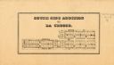
| Date: | 1857 |
|---|---|
| Description: | This map shows section corners, quarter section corners, foundry, steam saw mill, steam grist mill, planning mill, court house, baptist church, congregatio... |
If you didn't find the material you searched for, our Library Reference Staff can help.
Call our reference desk at 608-264-6535 or email us at: