 Filter: Categories of Wisconsin Historical Images
Filter: FORMAT_TYPE of prints, fine-art
Filter: County of Milwaukee
Filter: Type of Map or Atlas
Filter: Categories of Wisconsin Historical Images
Filter: FORMAT_TYPE of prints, fine-art
Filter: County of Milwaukee
Filter: Type of Map or Atlas

| Date: | 1900 |
|---|---|
| Description: | This map shows landownership, railroads, roads, churches, schools, cemeteries, post offices, townships, city wards, Lake Michigan, and rivers. The map incl... |
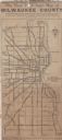
| Date: | 1923 |
|---|---|
| Description: | This map shows state, county, and city roadways as well as neighborhoods. Lake Michigan is on the far right. |

| Date: | 1837 |
|---|---|
| Description: | This map shows the proposed Rock River Canal, between Milwaukee County thru the west line of what is now Waukesha County. Also shows townships, roads, hydr... |
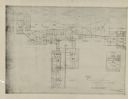
| Date: | 1925 |
|---|---|
| Description: | This series of 11 maps plus an index show the rivers as well as riverside buildings, landownership, and streets. |
If you didn't find the material you searched for, our Library Reference Staff can help.
Call our reference desk at 608-264-6535 or email us at: