 Filter: Categories of Wisconsin Historical Images
Filter: FORMAT_TYPE of prints, fine-art
Filter: County of Dane
Filter: Year of 1900-1999
Filter: Subject of transportation
Filter: Categories of Wisconsin Historical Images
Filter: FORMAT_TYPE of prints, fine-art
Filter: County of Dane
Filter: Year of 1900-1999
Filter: Subject of transportation
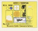
| Date: | 05 1971 |
|---|---|
| Description: | Poster announcing M.F.A. art exhibition for David G. Thompson. Held May 21-28, 1971, at the Wisconsin Center Concourse Gallery in Madison. Features various... |

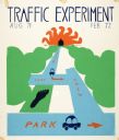
| Date: | 08 1971 |
|---|---|
| Description: | Poster advertising for an event occurring between August 1971 and February 1972 called the "Traffic Experiment," in Madison. Features screen printed silhou... |
| Date: | 08 1971 |
|---|---|
| Description: | Poster advertising for an event occurring between August 1971 and February 1972 called the "Traffic Experiment," in Madison. Features screen printed map of... |

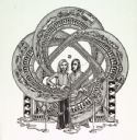
| Date: | 10 1971 |
|---|---|
| Description: | Poster publicizing an exhibition of art by John Risseeuw, at the 7th floor gallery, in the University of Wisconsin-Madison Humanities Building. Features mo... |

| Date: | 1968 |
|---|---|
| Description: | Finely detailed poster by artist Jonathan Chritton, on the theme of love. Features castles, hot air balloons, and other whimsical features in a symmetrical... |
| Date: | 1972 |
|---|---|
| Description: | Illustrated poster of the band Traffic made by artist John Chritton. |

| Date: | 1917 |
|---|---|
| Description: | Bird's-eye view of the University of Wisconsin-Madison campus. |

| Date: | 1930 |
|---|---|
| Description: | Lower left hand corner reads: "Compliment of the Madison Association of Commerce MADISON The Four Lake City WISCONSIN." Around the perimeter of the map is ... |

| Date: | 1937 |
|---|---|
| Description: | Includes points of interests in Madison and on the University of Wisconsin-Madison campus. Includes list of presidents of University of Wisconsin, 1849-193... |

| Date: | 1945 |
|---|---|
| Description: | This maps shows roads, railroads, parks, recreational areas, Lake Wingra, Lake Monona, and part of Lake Mendota. The map includes pictorial images that dep... |

| Date: | 1959 |
|---|---|
| Description: | This map shows wards and precincts by number, local streets, roads, parks, Shorewood Hills, Maple Bluff, Middleton, Verona, McFarland, Monona, Truax Field,... |
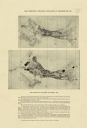
| Date: | 1918 |
|---|---|
| Description: | The map on the top shows the building situation in Madison in 1899, while the bottom map shows the building situation in 1916. Includes text in the lower m... |

| Date: | 1902 |
|---|---|
| Description: | This blueprint map shows land parcels, parks, blocks, and streets in the region north to Atwood Avenue, south to Lake Monona, west to Evergreen Avenue, and... |

| Date: | 1910 |
|---|---|
| Description: | This blueprint plat map shows the plan of lots and streets on a Madison hill south of Lake Monona. Includes annotations showing land prices in pencil. |

| Date: | 1929 |
|---|---|
| Description: | This plat map shows land parcels, blocks and streets located in a portion of the Mendota Beach subdivision. Streets include Adelia Street, Wesley Avenue, B... |

| Date: | 1925 |
|---|---|
| Description: | This map oriented with north to the upper right and shows 14 overlapping school districts. From left to right the schools include: Randall, Longfellow, Fra... |

| Date: | 1925 |
|---|---|
| Description: | This map oriented with north to the upper right shows 12 school districts of new proposed schools and existing schools. From left to right existing schools... |

| Date: | 1913 |
|---|---|
| Description: | This photocopy map shows plots with owners' names, land use both commercial and agricultural, and lot outlines on University land. Lake Mendota is labeled ... |

| Date: | 1905 |
|---|---|
| Description: | This blueprint map includes manuscript annotations in red showing land of Home Realty Co., Hon. Geo. B. Burrows, and A.O. Fox Industrial. |
If you didn't find the material you searched for, our Library Reference Staff can help.
Call our reference desk at 608-264-6535 or email us at: