 Filter: Categories of Wisconsin Historical Images
Filter: FORMAT_TYPE of prints, fine-art
Filter: County of Dane
Filter: Type of Map or Atlas
Filter: Categories of Wisconsin Historical Images
Filter: FORMAT_TYPE of prints, fine-art
Filter: County of Dane
Filter: Type of Map or Atlas

| Date: | 1927 |
|---|---|
| Description: | Blueprint-style map of Frost Woods on the shore of Lake Monona. The map indicates the locations of Indian mounds, an Indian camp, and various plants. There... |

| Date: | 1930 |
|---|---|
| Description: | Lower left hand corner reads: "Compliment of the Madison Association of Commerce MADISON The Four Lake City WISCONSIN." Around the perimeter of the map is ... |

| Date: | 1937 |
|---|---|
| Description: | Includes points of interests in Madison and on the University of Wisconsin-Madison campus. Includes list of presidents of University of Wisconsin, 1849-193... |

| Date: | 1861 |
|---|---|
| Description: | The township of Primrose, which is a detail from the plat map of Dane County. |

| Date: | 1861 |
|---|---|
| Description: | The township of Montrose, which is a detail from a Dane County plat map. |

| Date: | 1918 |
|---|---|
| Description: | This is a collection of two maps. One map is blue line print that includes illustrations and shows the location of buildings, gardens, plant life, and spri... |

| Date: | 1945 |
|---|---|
| Description: | This maps shows roads, railroads, parks, recreational areas, Lake Wingra, Lake Monona, and part of Lake Mendota. The map includes pictorial images that dep... |

| Date: | 1959 |
|---|---|
| Description: | This map shows wards and precincts by number, local streets, roads, parks, Shorewood Hills, Maple Bluff, Middleton, Verona, McFarland, Monona, Truax Field,... |

| Date: | 1892 |
|---|---|
| Description: | This map shows pipes of various sizes, hydrants with hydrant pressure, valves, wells, and projected lines. Includes labels for roadways, blocks, wards, par... |
| Date: | 1918 |
|---|---|
| Description: | The map on the top shows the building situation in Madison in 1899, while the bottom map shows the building situation in 1916. Includes text in the lower m... |

| Date: | 1902 |
|---|---|
| Description: | This blueprint map shows land parcels, parks, blocks, and streets in the region north to Atwood Avenue, south to Lake Monona, west to Evergreen Avenue, and... |

| Date: | 1905 |
|---|---|
| Description: | This blueprint map shows buildings and roads on Bascom Hill. University Avenue, Park street, Charter Street, and Lincoln Drive are labeled. Lake Mendota is... |

| Date: | 1910 |
|---|---|
| Description: | This blueprint plat map shows the plan of lots and streets on a Madison hill south of Lake Monona. Includes annotations showing land prices in pencil. |

| Date: | 1929 |
|---|---|
| Description: | This plat map shows land parcels, blocks and streets located in a portion of the Mendota Beach subdivision. Streets include Adelia Street, Wesley Avenue, B... |

| Date: | 1914 |
|---|---|
| Description: | This blueprint map includes manuscript annotations in red and shows number of acres and dates of acquisition (1905-1914) of each parcel of land, as well as... |
| Date: | 1878 |
|---|---|
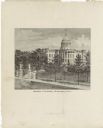
| Description: | This frontispiece lithograph shows the State Capitol with an American flag on flying on top of the dome. The grounds include trees and paths and are enclos... |

| Date: | 1890 |
|---|---|
| Description: | This map oriented with north towards the upper right shows sewers, cases of diphtheria and scarlet fever, schools, and public buildings. Lake Wingra is lab... |

| Date: | 1925 |
|---|---|
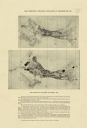
| Description: | This map oriented with north to the upper right and shows 14 overlapping school districts. From left to right the schools include: Randall, Longfellow, Fra... |

| Date: | 1925 |
|---|---|
| Description: | This map oriented with north to the upper right shows 12 school districts of new proposed schools and existing schools. From left to right existing schools... |

| Date: | 1913 |
|---|---|
| Description: | This photocopy map shows plots with owners' names, land use both commercial and agricultural, and lot outlines on University land. Lake Mendota is labeled ... |
If you didn't find the material you searched for, our Library Reference Staff can help.
Call our reference desk at 608-264-6535 or email us at: