| Date: | 1900 |
|---|---|
| Description: | This map shows AS&IR Railroad between Siskiwit and Nash (with dock), a proposed extension of AS&IR Railroad "now under construction" between Superior and N... |

| Date: | 1900 |
|---|---|
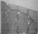
| Description: | Map showing a paper city located on the shore of Green Bay and south shore of the Fox River. The site is now part of Oshkosh. |
If you didn't find the material you searched for, our Library Reference Staff can help.
Call our reference desk at 608-264-6535 or email us at: