Filter: Categories of Wisconsin Historical Images
Filter: FORMAT_TYPE of drawings
Filter: Subject of water
Filter: Year of 1900-1999
Filter: Categories of Wisconsin Historical Images
Filter: FORMAT_TYPE of drawings
Filter: Subject of water
Filter: Year of 1900-1999

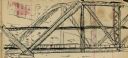
| Date: | 1936 |
|---|---|
| Description: | This map is red and black ink on tracing cloth and is oriented with north to the upper left. This hand-drawn map shows a central portion of the military ro... |
| Date: | 1938 |
|---|---|
| Description: | Reproduction of a color rendering of Olin Terraces, an early proposal for a Madison civic center by Frank Lloyd Wright. This perspective is the view from ... |
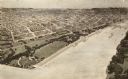
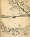
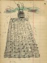
| Date: | 1900 |
|---|---|
| Description: | A drawing of Levee Park in La Crosse, with the Mississippi River in the foreground, and La Crosse in the background. |

| Date: | 06 28 1958 |
|---|---|
| Description: | Official plat map drawn in ink and watercolor, T. 15 N, R. 11 E. |
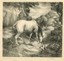
| Date: | 12 1938 |
|---|---|
| Description: | Horse drinking from a stream with a small dog nearby. |
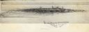
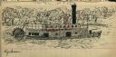
| Date: | 1903 |
|---|---|
| Description: | Drawing of steamboat in the distance on a river (possibly the Wisconsin River). |
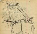
| Date: | 1903 |
|---|---|
| Description: | Lock and dam system on a canal along the Mississippi River. |
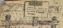
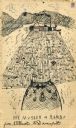
| Date: | 1903 |
|---|---|
| Description: | Sign posted on a fence announcing a lost camera near the town of Prairie du Sac and requesting its return to Herbert Fowler. |
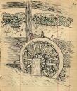
| Date: | 1903 |
|---|---|
| Description: | Drawing of a ship's steering wheel with river and trees visible through the cabin. |
| Date: | 1903 |
|---|---|
| Description: | Drawing of a steamboat pulling a raft of cut boards. |
| Date: | 1903 |
|---|---|
| Description: | Drawing of the steamboat Weyerhauser on the Mississippi River. |
| Date: | 1903 |
|---|---|
| Description: | Drawing of the "Rambo" and "Musser" transporting a log raft on the Mississippi River. |

| Date: | 1941 |
|---|---|
| Description: | Hand-drawn, watercolor and ink, map of Lake Mendota. Locations and many small figures appear around the shore with explanations referring to Indian legends... |

| Date: | 1906 |
|---|---|
| Description: | Hand-drawn topographical map of the Turville Estate. |

| Date: | 1906 |
|---|---|
| Description: | Topographical map of Turville Point and lands to the South to Nine Springs Creek. |
| Date: | 1953 |
|---|---|
| Description: | Interior perspective drawing of the living room of the Fred Graber house designed and drawn by architect John Randal McDonald. |
| Date: | 1952 |
|---|---|
| Description: | Interior perspectives of the Robert Johns residence designed and drawn by architect John Randal McDonald. McDonald gave the project two names, "Spindrift"... |

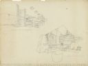
| Date: | 1956 |
|---|---|
| Description: | Pencil on vellum drawing showing an interior perspective of the living room/balcony space and an exterior perspective of the residence designed and drawn b... |
If you didn't find the material you searched for, our Library Reference Staff can help.
Call our reference desk at 608-264-6535 or email us at: