 Filter: Categories of Wisconsin Historical Images
Filter: FORMAT_TYPE of drawings
Filter: County of Green
Filter: Categories of Wisconsin Historical Images
Filter: FORMAT_TYPE of drawings
Filter: County of Green
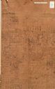
| Date: | |
|---|---|
| Description: | Hand-drawn map of the town of Cadiz, Wisconsin near the Illinois border showing plots of landownership. The map also includes one landmark of the Pecatonic... |
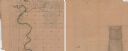
| Date: | 1850 |
|---|---|
| Description: | A hand-drawn plat map of the area along the Pecatonica River in the Town of Cadiz, Green County, Wisconsin. |
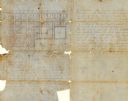
| Date: | 08 1851 |
|---|---|
| Description: | Ink on paper. Includes explanation and a certification signed by Jacob Marty, Electa Marty, and a justice of the peace. Original map is very light and in f... |

| Date: | 1856 |
|---|---|
| Description: | This map of Woodman's Addition in Mineral Point is pen-and-ink on paper. The map includes certifications signed by John B. Whitelaw (surveyor), Cyrus Woodm... |
If you didn't find the material you searched for, our Library Reference Staff can help.
Call our reference desk at 608-264-6535 or email us at: