
| Date: | 1836 |
|---|---|
| Description: | An ink on paper, hand-drawn map of the survey of the (Township No. 8, Range No. 16 East of the 4 Meridian) Town of Ixonia, Jefferson County, Wisconsin incl... |

| Date: | 07 1868 |
|---|---|
| Description: | A hand-drawn map of a portion of Jackson County, Wisconsin between Township No. 21 north, range number 4 West and township no. 21 north, range no. 3 west, ... |
| Date: | |
|---|---|
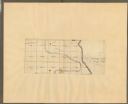
| Description: | An ink and water color on paper, hand-drawn map showing the section divisions in the southern half of the Janesville Township (Township 3 North, Range 12 E... |

| Date: | 1947 |
|---|---|
| Description: | An ink on paper, hand-drawn map of Jefferson County, Wisconsin, that identifies named hills, other points of interest, and the Lake Mills moraine system in... |

| Date: | 12 25 1942 |
|---|---|
| Description: | This hand-drawn map shows the highways and features in the Rock Lake-Lake Mills area in the towns of Aztalan and Lake Mills, Jefferson County, Wisconsin. T... |

| Date: | |
|---|---|
| Description: | An ink and watercolor on tracing map showing the sections and surveyed lots in the vicinity of the Rock and Crawfish rivers in the central and eastern port... |

| Date: | |
|---|---|
| Description: | An ink and pencil on paper hand-drawn map showing sections and landowners along the north bank of the Fox River in the towns of Grand Chute and Vandenbroek... |
| Date: | 1899 |
|---|---|
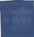
| Description: | Topographical map showing ridges, water courses, boundary lines, and trails and roads near the Stanley McCormick's Riven Rock estate in El Montecito, Santa... |

| Date: | 1899 |
|---|---|
| Description: | Map of the Santa Barbara Channel California area showing property boundaries and some geographical features. The Riven Rock Estate has been outlined in yel... |
| Date: | 1899 |
|---|---|
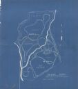
| Description: | Overhead map of the Stanley McCormick's Riven Rock estate in El Montecito, Santa Barbara, California. The map shows the placement of dwellings and fields, ... |

| Date: | 1899 |
|---|---|
| Description: | A map showing the shoreline of a portion of El Montecito, Santa Barbara County, California. The map shows properties along the Pacific Ocean, and may have ... |

| Date: | 1836 |
|---|---|
| Description: | A series of ink, watercolor, and pencil on paper, hand-drawn maps of the townships of Darlington and Gratiot in Lafayette County, Wisconsin, showing the to... |

| Date: | 1830 |
|---|---|
| Description: | An ink on paper, hand-drawn map, showing the wagons roads that travel through Lafayette County, traveling between Galena, Illinois, and Mineral Point, Wisc... |
| Date: | 1920 |
|---|---|
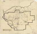
| Description: | An ink on tracing paper, hand-drawn map that shows lead mines, the boundary of the lead bearing strata, and the military road in Lafayette, Grant, Iowa, an... |

| Date: | 1836 |
|---|---|
| Description: | A hand-drawn map of the mouth of the Manitowoc River at Lake Michigan, showing depth of the water by contour lines. The included inset map shows the region... |

| Date: | |
|---|---|
| Description: | A hand-drawn Geological map of the Upper Peninsula of Michigan, showing the counties and streams of that area. The map also identifies the location of the... |

| Date: | |
|---|---|
| Description: | An ink, watercolor, and pencil on paper, hand-drawn map that shows the Michigan-Wisconsin boundary in Iron, Vilas, Forest, Florence, and Marinette counties... |
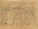
| Date: | 1840 |
|---|---|
| Description: | An ink, watercolor, and pencil on tracing paper, hand-drawn map of Milwaukee County, Wisconsin that shows the town and range system, sections, lakes and st... |
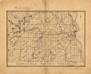
| Date: | 1844 |
|---|---|
| Description: | An ink on paper, hand-drawn map of Milwaukee County that shows the sectioning of townships, the boundary of the canal grant, roads, streams, lakes, includi... |

| Date: | 1837 |
|---|---|
| Description: | A pen and ink on tracing paper, hand-drawn and colored map the proposed route of the Milwaukee and Rock River Canal, ranging from the Rock River in the wes... |
If you didn't find the material you searched for, our Library Reference Staff can help.
Call our reference desk at 608-264-6535 or email us at: