 Filter: Categories of Wisconsin Historical Images
Filter: FORMAT_TYPE of digital file
Filter: Year of 1800-1899
Filter: Subject of railroads
Filter: Categories of Wisconsin Historical Images
Filter: FORMAT_TYPE of digital file
Filter: Year of 1800-1899
Filter: Subject of railroads

| Date: | 1890 |
|---|---|
| Description: | Bird's-eye map of Beloit with insets of Williams Engine Works, Eclipse Wind Engine Co., and John Foster & Co. Turtle Creek is in the lower section, and the... |

| Date: | 1868 |
|---|---|
| Description: | This 1868 birds-eye view depicts the buildings, streets, railroad, vegetation and topography of Columbus, Wisconsin. The high school, cemetery, railroad de... |
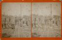
| Date: | 06 12 1899 |
|---|---|
| Description: | Elevated view of a town with a railroad bridge crossing over a river. Several individuals are visible crossing the bridge. Sign near bridge says: "Willow R... |

| Date: | 1896 |
|---|---|
| Description: | This 1898 map shows the township and range system, sections, cities and villages, railroads, roads, vacant land and land sold by the Wisconsin Central Rail... |

| Date: | 1887 |
|---|---|
| Description: | City water works system map. Pencil annotation on the top right reads: "Period represented is after 1887 and before Aug. 1891". The middle of the map has a... |
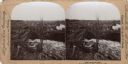
| Date: | 1878 |
|---|---|
| Description: | Stereograph of a bearded man with vest and suit posing on a narrow gauge railroad at the granite works in Montello. Workmen are posing around him. Most of ... |
If you didn't find the material you searched for, our Library Reference Staff can help.
Call our reference desk at 608-264-6535 or email us at: