 Filter: Categories of Wisconsin Historical Images
Filter: FORMAT_TYPE of digital file
Filter: Subject of hills
Filter: Categories of Wisconsin Historical Images
Filter: FORMAT_TYPE of digital file
Filter: Subject of hills

| Date: | 1886 |
|---|---|
| Description: | Bird's-eye view of Bayfield, county seat of Bayfield County. On the lower left side is an inset for Bayfield and the Apostle Islands. |
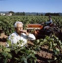
| Date: | 1975 |
|---|---|
| Description: | Color photograph of a man drinking from a glass of wine in a vineyard in France. In the background a vineyard worker is cultivating the field with an Inter... |
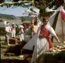
| Date: | |
|---|---|
| Description: | Tents, people in costume, and food tables at a carnival on the grounds of Taliesin. Taliesin was the Wisconsin residence of Frank Lloyd Wright and the Tali... |

| Date: | 1898 |
|---|---|
| Description: | View from water tower, showing the grove where Black Hawk's pursuers were supposed to have camped in 1832. The group of men in the foreground are digging f... |
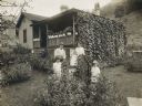
| Date: | 1919 |
|---|---|
| Description: | A family of five posing in front of an International Harvester "company house" in the coal mining town of Benham. |
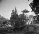
| Date: | |
|---|---|
| Description: | A view of the open-air pavilion at Sheldon House Hotel. The pavilion stands in a wooded area with mountains visible in the distance. A set of wooden stairs... |

| Date: | |
|---|---|
| Description: | A view of the shoreline of Devil's Lake with railroad tracks in the foreground. On the back of the photograph is the photographer's information: "Sim Mould... |
| Date: | |
|---|---|
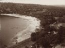
| Description: | Elevated view of the north end of Devil's Lake and Cliff House. A number of buildings are around the shoreline with railroad tracks in the foreground. A lo... |

| Date: | |
|---|---|
| Description: | View from shoreline of Devil's Lake with the far shoreline in the background. |

| Date: | |
|---|---|
| Description: | Elevated view of Devil's Lake from the top of the bluffs, talus slope visible on right. |

| Date: | |
|---|---|
| Description: | Elevated view of Devil's Lake from the top of the bluffs, talus slope visible on right. |
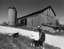
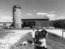
| Date: | 2004 |
|---|---|
| Description: | Pam Donald and her children, Joey, Jimmy and Mary, live at N8914 N. Pole Road (Section 11). |
| Date: | |
|---|---|
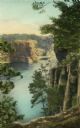
| Description: | Hand-colored view of High Rock from Romance Cliff published by the Albertype Company, Brooklyn, New York. |
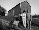
| Date: | 2004 |
|---|---|
| Description: | Karen Huettner and son, Kevin, live at N7561 Hwy 175 (Section 36). |
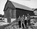
| Date: | 2004 |
|---|---|
| Description: | This barn is at W487 Zion Church Rd (Section 26). Allen and Mary Beth Eilbes and sons Michael, Andrew and Mathew (by age) live here. |
| Date: | 2004 |
|---|---|
| Description: | Ken and Sandy Gerlach live at N8684 Bancroft Rd (Section 15). |
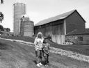
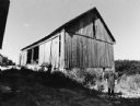
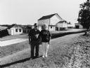
| Date: | 2004 |
|---|---|
| Description: | The Donald property is located on a very high hill. The old silo dates to 1911. The Department of Natural Resources owns and uses the old barn. |

| Date: | 2004 |
|---|---|
| Description: | About 40 elk are currently being raised on the Enderle farm by Tim Enderle. |
| Date: | 2004 |
|---|---|
| Description: | The last time cows were milked on the Schwertz property was in the 1960s. |
| Date: | 2004 |
|---|---|
| Description: | The Margelofskys moved here in 1971. The previous owner was Henry Marose, and he did not milk either. |
If you didn't find the material you searched for, our Library Reference Staff can help.
Call our reference desk at 608-264-6535 or email us at: