 Filter: Categories of Wisconsin Historical Images
Filter: FORMAT_TYPE of digital file
Filter: Type of Map or Atlas
Filter: Categories of Wisconsin Historical Images
Filter: FORMAT_TYPE of digital file
Filter: Type of Map or Atlas

| Date: | 1952 |
|---|---|
| Description: | The famous Dells of the Wisconsin River. A souvenir map embellished with bits of history and points of interest. |

| Date: | 1896 |
|---|---|
| Description: | This 1898 map shows the township and range system, sections, cities and villages, railroads, roads, vacant land and land sold by the Wisconsin Central Rail... |

| Date: | 1887 |
|---|---|
| Description: | City water works system map. Pencil annotation on the top right reads: "Period represented is after 1887 and before Aug. 1891". The middle of the map has a... |
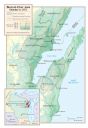
| Date: | 1999 |
|---|---|
| Description: | Map depicting the burned over area created by the fire on October 8, 1871. Map includes inset of Wisconsin and surrounding states with detail of area impac... |

| Date: | 1947 |
|---|---|
| Description: | This photocopy of a hand-drawn map shows streets, a public square, lots, and extensive registrations and certifications. |

| Date: | 1915 |
|---|---|
| Description: | This map shows highways in the state and includes in the left bottom margin information on the population to be served by proposed roads. There are handwri... |
If you didn't find the material you searched for, our Library Reference Staff can help.
Call our reference desk at 608-264-6535 or email us at: