Filter: Categories of Wisconsin Historical Images
Filter: FORMAT_NUMBER_ORG of PH 6445
Filter: Subject of transportation
Filter: Subject of human settlements
Filter: Categories of Wisconsin Historical Images
Filter: FORMAT_NUMBER_ORG of PH 6445
Filter: Subject of transportation
Filter: Subject of human settlements
| Date: | |
|---|---|
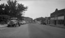
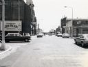
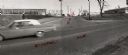
| Description: | Main Street (State Highway 80) in Necedah, Juneau County, looking south. Automobiles are parked at an angle on one side of the street. |
| Date: | 12 04 1967 |
|---|---|
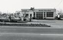
| Description: | Ronnie's Mobil Station located on Main Street (STH 13). |

| Date: | 02 05 1975 |
|---|---|
| Description: | Businesses at the intersection of Capron and Water Street downtown. In the foreground is a beer truck making a delivery to the Corner Bar and across the s... |
| Date: | 07 28 1970 |
|---|---|
| Description: | Traffic on Stevens Point's Second Street. |
| Date: | 07 28 1971 |
|---|---|
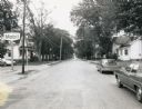
| Description: | Older residences along Second Street in Stevens Point. |
| Date: | 07 28 1971 |
|---|---|
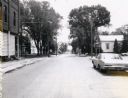
| Description: | The Fourth Street intersection in Stevens Point. |
| Date: | 06 29 1968 |
|---|---|
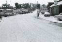
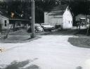
| Description: | Monroe County Highway P in Kendall, Wisconsin, looking south. The view includes an automobile service station and dealership, with automobiles and trucks ... |

| Date: | |
|---|---|
| Description: | Town Line Road in Wausau, looking west, toward a residential neighborhood. On the left is the Weltman Furniture store which also appears in Image 36020. |
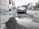
| Date: | 11 23 1965 |
|---|---|
| Description: | Intersection of US Highway 51, locally known as Schofield Avenue, and Ross Street in Schofield, Wisconsin. Drott manufacturing can be seen at left and Nesb... |
| Date: | 08 03 1973 |
|---|---|
| Description: | View of an Elroy alley from Cedar Street. The deteriorating garage in the foreground is of an unusual design. |

| Date: | 1983 |
|---|---|
| Description: | View of downtown Wausau looking east from the Scott Street Bridge. |
| Date: | 12 12 1966 |
|---|---|
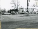
| Description: | Texaco Oil service station, apparently built from a war surplus quonset hut-style building. |
| Date: | 1967 |
|---|---|
| Description: | Pedestrians walking on the sidewalk along State Highway 21 & 73 in Wautoma. Parked automobiles and parking meters are also visible. |
| Date: | 1967 |
|---|---|
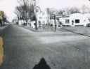
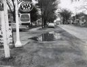
| Description: | A Wautoma, Wisconsin neighborhood. On both sides of the street in both the foreground and middle distance are service stations, beyond them is a residenti... |
| Date: | 1967 |
|---|---|
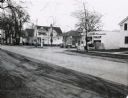
| Description: | A Standard Oil service station located on Oxford Street (State Highway 21&73) in Wautoma, Wisconsin. This photograph relates to the neighborhood view in 3... |
| Date: | 1967 |
|---|---|
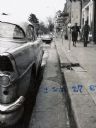
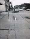
| Description: | Traffic on Oxford Street (State Highway 21&73), with a parking meter in the foreground and old storefronts in the distance. |
| Date: | 1967 |
|---|---|
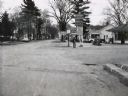
| Description: | Deep Rock gasoline service station located at the intersection of Scott Street and Oxford Street (STH 21&73) in Wautoma, Wisconsin. |
If you didn't find the material you searched for, our Library Reference Staff can help.
Call our reference desk at 608-264-6535 or email us at: