| Date: | 1902 |
|---|---|
| Description: | A traveling medicine wagon with saleswomen and vendor selling Westmore's Hair Tonic. |

| Date: | 07 16 1926 |
|---|---|
| Description: | Home Economics building, University of Wisconsin, 1300 Linden Drive, from the Southwest. |

| Date: | |
|---|---|
| Description: | Elevated view of University Heights, looking north from Ely Place towards Bascom Hall. The following houses are visible: Professor Richard T. Ely house, 20... |

| Date: | 2006 |
|---|---|
| Description: | Father and two children stopped at an intersection while on a bike ride. |

| Date: | 05 08 2009 |
|---|---|
| Description: | James, a recycling man, poses with his wagon of recyclables. |

| Date: | 2006 |
|---|---|
| Description: | View from across street of exterior of "Sleep Concepts" store and rug store. Bean bags are set up on the sidewalk near a sandwich board sign. |

| Date: | 05 28 2007 |
|---|---|
| Description: | A young girl dressed in red, white, and blue is watching the Memorial Day parade while holding an American flag and sitting in a chair on the sidewalk. |

| Date: | 1900 |
|---|---|
| Description: | View across intersection toward the library on the left, and houses behind a tree-lined sidewalk on the right. |

| Date: | |
|---|---|
| Description: | Stereograph of southwest facade on Martin Street. Built circa 1872. Architect was E.T. Mix. Dirt road in front, and the tower of the Immanuel Church is in... |

| Date: | |
|---|---|
| Description: | Stereograph view of construction of the Wisconsin State Capitol dome during the construction of the fourth capitol building. The image features the Capitol... |

| Date: | |
|---|---|
| Description: | This detailed map shows fortifications, headquarters, location and dates of battles, street outline of Atlanta, roads, railroads, vegetation, drainage, rel... |

| Date: | 1862 |
|---|---|
| Description: | This detailed map shows batteries and rifle pits, railroads, common and military roads, turnpikes, city streets and names, bridges, ferries, rural houses a... |

| Date: | 1900 |
|---|---|
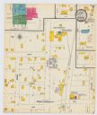
| Description: | A Sanborn map of a portion of Seymour, Wisconsin. |
If you didn't find the material you searched for, our Library Reference Staff can help.
Call our reference desk at 608-264-6535 or email us at: