 Filter: Categories of Wisconsin Historical Images
Filter: FORMAT_DIMENSIONS of unknown
Filter: Subject of service industries
Filter: Subject of streets
Filter: Categories of Wisconsin Historical Images
Filter: FORMAT_DIMENSIONS of unknown
Filter: Subject of service industries
Filter: Subject of streets

| Date: | 12 11 1926 |
|---|---|
| Description: | Fire destroyed the Atlas Flour Mill, causing an estimated $100,000 in damage. Thirteen engine companies, six truck companies, and two fire boats fought the... |

| Date: | 04 17 1934 |
|---|---|
| Description: | View across street towards two new tanks being delivered by the Heil Co. of Milwaukee on a Heil Company truck. The truck is parked in front of the Fauerbac... |

| Date: | 1977 |
|---|---|
| Description: | A view from the west of the Fess Hotel, 123 East Doty Street. |

| Date: | 2007 |
|---|---|
| Description: | An exterior view from across street of Bodega Brew Pub on corner of Pearl Street. |

| Date: | 2006 |
|---|---|
| Description: | View from across street of "Buzzard Billy's." There is a decorative fish on top of the establishment. |
| Date: | 1930 |
|---|---|
| Description: | A man and his two children pose at the corner near the post office. |

| Date: | 1974 |
|---|---|
| Description: | An exterior view of Trameri's Bar at 625 West Main Street. |

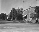
| Date: | |
|---|---|
| Description: | Exterior view across the street towards the post office at 1620 East Capitol Drive. |

| Date: | 12 1912 |
|---|---|
| Description: | Sanborn map of Sun Prairie, which includes an index and information about water facilities and the fire department. Includes a small inset map of the State... |

| Date: | 04 1901 |
|---|---|
| Description: | A Sanborn map of Watertown, including an index and a key. |

| Date: | 1908 |
|---|---|
| Description: | A Sanborn fire map of Brodhead. Includes an inset at top right showing distances from P.O. |
If you didn't find the material you searched for, our Library Reference Staff can help.
Call our reference desk at 608-264-6535 or email us at:


