 Filter: Categories of Wisconsin Historical Images
Filter: FORMAT_DIMENSIONS of unknown
Filter: Subject of service industries
Filter: Subject of dwellings
Filter: Categories of Wisconsin Historical Images
Filter: FORMAT_DIMENSIONS of unknown
Filter: Subject of service industries
Filter: Subject of dwellings

| Date: | 09 12 1931 |
|---|---|
| Description: | A&W Root Beer stand at 900 S. Park Street. |

| Date: | 03 01 1927 |
|---|---|
| Description: | Capitol Theatre, 211 State Street, under construction. American Bridge Co. on beams, and an Esser's City Market delivery truck. |
| Date: | 1910 |
|---|---|
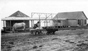
| Description: | Tom Stahl's dog team pulling wagon loaded with goods and child past buildings in La Pointe. |
| Date: | 1910 |
|---|---|
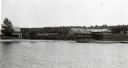
| Description: | View from water of the Old Mission Inn on the shore of Lake Superior in La Pointe on Madeline Island. Dwelling to the left is a portion of the lower dormit... |
| Date: | 1910 |
|---|---|
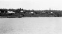
| Description: | View from water of Mission cottages along shoreline of Lake Superior in La Pointe, Madeline Island. |

| Date: | 1939 |
|---|---|
| Description: | Hazy eastern view of the Capitol Heating Plant on East Main Street. |

| Date: | 1920 |
|---|---|
| Description: | Watercolor of the "Old Milton House" done by Mrs. Louise Westby of Fort Atkinson, Wisconsin. The Milton House was a part of the Underground Railroad during... |

| Date: | 2009 |
|---|---|
| Description: | Customers around outside seating at Jule's Coffee shop on Pearl Street. |
| Date: | 1910 |
|---|---|
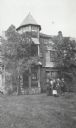
| Description: | Group of people standing in front of Cedar Bark Lodge on (Wilson) Hermit Island, Apostle Islands. Cedar Bark Lodge was also known as the Hermitage. |

| Date: | 12 1912 |
|---|---|
| Description: | Sanborn map of Sun Prairie, which includes an index and information about water facilities and the fire department. Includes a small inset map of the State... |

| Date: | 1908 |
|---|---|
| Description: | A Sanborn fire map of Brodhead. Includes an inset at top right showing distances from P.O. |

| Date: | 1877 |
|---|---|
| Description: | A page from an illustrated historical atlas showing four residences, a hotel and the flouring mill of John Ochsner. |
If you didn't find the material you searched for, our Library Reference Staff can help.
Call our reference desk at 608-264-6535 or email us at:


