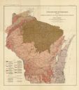
| Date: | 1915 |
|---|---|
| Description: | This map shows the extent of Wisconsin and pre-Wisconsin drift. The bottom left of the map includes a map categorizing the colors used into geologic period... |

| Date: | 1918 |
|---|---|
| Description: | Manuscript map of the Chequamegon Bay area on Lake Superior drawn by Warren W. Witmer and illustrated with sketches by Mary L. Wright Witmer in ink and wat... |
If you didn't find the material you searched for, our Library Reference Staff can help.
Call our reference desk at 608-264-6535 or email us at: