| Date: | 1889 |
|---|---|
| Description: | Illustration of the exterior of the Fuller Opera House, which is a detail from a bird's-eye view map of Madison. |

| Date: | 1889 |
|---|---|
| Description: | Dane County Courthouse, begun in the fall of 1883 and finished in the spring of 1886. The cost, including equipment, was a little over $180,000. |

| Date: | 1913 |
|---|---|
| Description: | A wall atlas of Sauk County, Wisconsin, displaying its 22 towns. On the left side are advertisements for local businesses. |

| Date: | |
|---|---|
| Description: | This detailed map shows fortifications, headquarters, location and dates of battles, street outline of Atlanta, roads, railroads, vegetation, drainage, rel... |

| Date: | 1908 |
|---|---|
| Description: | A detailed map of Michigan Island and Gull Island in the Apostle Islands group (T51N, R1W, 4 M) that shows sections, landowners, the Michigan Island Lighth... |

| Date: | 1894 |
|---|---|
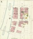
| Description: | Sanborn map of Milwaukee, with the Milwaukee River on the left, and Water Street in the center. There are two iron draw bridges over the river. |

| Date: | 12 1912 |
|---|---|
| Description: | Sanborn map of Sun Prairie, which includes an index and information about water facilities and the fire department. Includes a small inset map of the State... |

| Date: | 12 1912 |
|---|---|
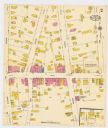
| Description: | Sanborn map of Sun Prairie, showing Main, Center and Church Streets. |

| Date: | 12 1912 |
|---|---|
| Description: | Sanborn Map of Sun Prairie. The map highlights the public and parochial schools, the exhange, and church buildings, etc. |

| Date: | 1908 |
|---|---|
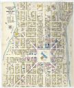
| Description: | A Sanborn map featuring the Capitol Square and surrounding business district. |

| Date: | 04 1901 |
|---|---|
| Description: | A Sanborn map of Watertown, including an index and a key. |
If you didn't find the material you searched for, our Library Reference Staff can help.
Call our reference desk at 608-264-6535 or email us at: