Filter: Categories of Wisconsin Historical Images
Filter: FORMAT_DIMENSIONS of 9 x 7 inches
Filter: Subject of intellectual life
Filter: Categories of Wisconsin Historical Images
Filter: FORMAT_DIMENSIONS of 9 x 7 inches
Filter: Subject of intellectual life
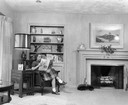
| Date: | |
|---|---|
| Description: | Woman reading "House Beautiful" magazine at Greenwood House. |

| Date: | 10 17 1963 |
|---|---|
| Description: | A librarian reads a children's book aloud to young boys and girls. |

| Date: | 1935 |
|---|---|
| Description: | African American students work on a school paper as part of the Farm Security Administration sharecropper resettlement project. |

| Date: | 1861 |
|---|---|
| Description: | Bird's-eye map of Fond du Lac, "drawn after nature," with a parade of soldiers marching down the street. |
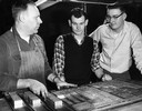
| Date: | 1950 |
|---|---|
| Description: | Sports editor and sports reporter from the "Wisconsin State Journal" confer with a printer over trays of lead type. |

| Date: | 1950 |
|---|---|
| Description: | A man and woman look at wall-size maps as he points to the east coast of the United States. |

| Date: | 1950 |
|---|---|
| Description: | A woman writes a note at a small writing desk in her kitchen. |
| Date: | 1954 |
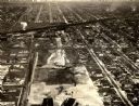
|---|---|
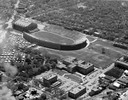
| Description: | Aerial view of Camp Randall Stadium and Field House on the University of Wisconsin-Madison campus. |
| Date: | 1934 |
|---|---|
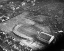
| Description: | Aerial view of Camp Randall Stadium and Field House on the University of Wisconsin-Madison campus. |
| Date: | 1947 |
|---|---|
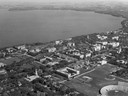
| Description: | Aerial of University of Wisconsin-Madison campus with Camp Randall in the lower right corner and Lake Mendota, looking northeast to Maple Bluff. |
| Date: | 1900 |
|---|---|
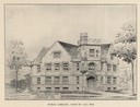
| Description: | Drawing of the exterior of the Fond du Lac Public Library. Van Ryn and Degelleke architects. Caption reads: "Public Library, Fond du Lac, Wis." |
| Date: | 1920 |
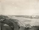
|---|---|
| Description: | Aerial view with fishing piers, coal factories, a bridge, and railroad tracks. |

| Date: | 1950 |
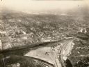
|---|---|
| Description: | Aerial view of downtown and river. |
| Date: | 1934 |
|---|---|
| Description: | Aerial view of Janesville showing the river fill for the new sewerage disposal plant. |
| Date: | 1934 |
|---|---|
| Description: | Aerial view of the play area for Roosevelt School. |

| Date: | |
|---|---|
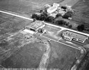
| Description: | Aerial view of the southeast, with West Broadway and the South Beltline running through the image. Also shows Nob Hill restaurant, the Toki family farm and... |

| Date: | 1950 |
|---|---|
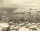
| Description: | An aerial view of town, showing a major industrial area. |

| Date: | 1955 |
|---|---|
| Description: | Aerial view of Castle Rock Dam on the Wisconsin River. |
If you didn't find the material you searched for, our Library Reference Staff can help.
Call our reference desk at 608-264-6535 or email us at: