Filter: Categories of Wisconsin Historical Images
Filter: FORMAT_DIMENSIONS of 9 x 7 inches
Filter: Subject of aerial photographs
Filter: Categories of Wisconsin Historical Images
Filter: FORMAT_DIMENSIONS of 9 x 7 inches
Filter: Subject of aerial photographs
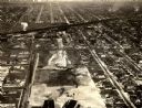
| Date: | 1954 |
|---|---|
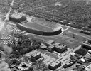
| Description: | Aerial view of Camp Randall Stadium and Field House on the University of Wisconsin-Madison campus. |
| Date: | 1934 |
|---|---|
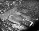
| Description: | Aerial view of Camp Randall Stadium and Field House on the University of Wisconsin-Madison campus. |
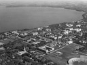
| Date: | 1947 |
|---|---|
| Description: | Aerial of University of Wisconsin-Madison campus with Camp Randall in the lower right corner and Lake Mendota, looking northeast to Maple Bluff. |
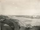
| Date: | 1920 |
|---|---|
| Description: | Aerial view with fishing piers, coal factories, a bridge, and railroad tracks. |

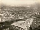
| Date: | 1950 |
|---|---|
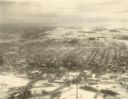
| Description: | Aerial view of downtown and river. |
| Date: | 1934 |
|---|---|
| Description: | Aerial view of Janesville showing the river fill for the new sewerage disposal plant. |
| Date: | 1934 |
|---|---|
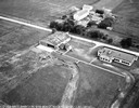
| Description: | Aerial view of the play area for Roosevelt School. |

| Date: | |
|---|---|
| Description: | Aerial view of the southeast, with West Broadway and the South Beltline running through the image. Also shows Nob Hill restaurant, the Toki family farm and... |

| Date: | 1950 |
|---|---|
| Description: | An aerial view of town, showing a major industrial area. |

| Date: | 1955 |
|---|---|
| Description: | Aerial view of Castle Rock Dam on the Wisconsin River. |
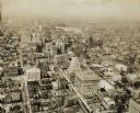
| Date: | 1930 |
|---|---|
| Description: | Aerial view of downtown area including churches, homes, and large buildings, stretching to the horizon. |

| Date: | |
|---|---|
| Description: | Aerial view includes farm and orchards, surrounded by neighborhoods. A water tower is on the upper left half. |

| Date: | 07 15 1958 |
|---|---|
| Description: | Aerial view of Eagle Heights Farm, Eagle Heights Woods and part of Lake Mendota. Sites labeled on the image are Eagle Heights, Tent Colony, Apartment Site,... |

| Date: | |
|---|---|
| Description: | An aerial view of Governor's Island. A cutout of an arrow has been added. |

| Date: | 1959 |
|---|---|
| Description: | Aerial view of the Westgate Shopping Center under construction. |

| Date: | |
|---|---|
| Description: | Aerial view of Vieth's Park subdivision on the north shore of Lake Mendota. |

| Date: | |
|---|---|
| Description: | Aerial view of Madison featuring Central High School/Madison Area Technical College (MATC) at top center. |

| Date: | 06 1960 |
|---|---|
| Description: | Aerial view looking northwest showing an area to be redeveloped into high-rise dormitories. Lake Mendota and Bascom Woods can be seen at the top. Universit... |
If you didn't find the material you searched for, our Library Reference Staff can help.
Call our reference desk at 608-264-6535 or email us at: