Filter: Categories of Wisconsin Historical Images
Filter: FORMAT_DIMENSIONS of 21 x 25 inches
Filter: Subject of land
Filter: Categories of Wisconsin Historical Images
Filter: FORMAT_DIMENSIONS of 21 x 25 inches
Filter: Subject of land
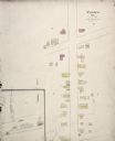
| Date: | 10 1914 |
|---|---|
| Description: | Page 2 of a Sanborn-Perris map of Pewaukee. |
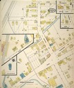
| Date: | 07 1924 |
|---|---|
| Description: | Page 3 of Sanborn-Perris map of Pewaukee. |

| Date: | 10 1884 |
|---|---|
| Description: | Sanborn insurance map of Black River Falls covering the area bordered by the Black River on the East, 3rd Street on the West, Johnson Street on the North, ... |

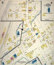
| Date: | 09 1884 |
|---|---|
| Description: | Sanborn map of Fort Atkinson including Barrie, Germany, and North Water Streets. |

| Date: | 1910 |
|---|---|
| Description: | Sanborn insurance map of Milwaukee showing a portion of Jones Island with Lake Michigan at the top and the Milwaukee River at the bottom. |
If you didn't find the material you searched for, our Library Reference Staff can help.
Call our reference desk at 608-264-6535 or email us at: