Filter: Categories of Wisconsin Historical Images
Filter: FORMAT_DIMENSIONS of 14 x 11 inches
Filter: Subject of roads
Filter: Categories of Wisconsin Historical Images
Filter: FORMAT_DIMENSIONS of 14 x 11 inches
Filter: Subject of roads

| Date: | 06 07 1954 |
|---|---|
| Description: | Aerial view of the Midvale neighborhood under construction showing the intersection of Midvale and Tokay Boulevards near the southwestern city limits of Ma... |

| Date: | 1955 |
|---|---|
| Description: | Aerial view of Midvale neighborhood under construction near Madison's southwestern city limits. The view is focused on the area bounded by Tokay Boulevard,... |

| Date: | 1829 |
|---|---|
| Description: | Drawing of Cassville depicting a horse cart on the river's edge, with men and boats. |
| Date: | 1952 |
|---|---|
| Description: | Watercolor painting of a Wolff-Kubly & Hirsig building (the site of the current Wisconsin Historical Museum) under construction. |

| Date: | 05 1981 |
|---|---|
| Description: | View from across street of house on 2051 Camilla Street. |

| Date: | 05 1981 |
|---|---|
| Description: | View across road of buildings at 202 - 222 East Washington Avenue including Pahl Tire Co., Paradise Printing and Federal Center. |

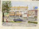
| Date: | 05 1981 |
|---|---|
| Description: | Building on corner of 2150 East Washington Avenue. |

| Date: | 05 1981 |
|---|---|
| Description: | Exterior view of building on 1010 South Park Street. |

| Date: | 05 1981 |
|---|---|
| Description: | View across road of building on East Main Street. |

| Date: | 05 1981 |
|---|---|
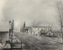
| Description: | Odana and West Platte Drive, Madison, Dane County. |

| Date: | 02 18 1996 |
|---|---|
| Description: | The Hotel Washington being destroyed by a fire on Feb. 18, 1996. |

| Date: | 1940 |
|---|---|
| Description: | Aerial view of the west side of the University of Wisconsin-Madison Campus looking towards Bascom Hill. Lake Mendota is in the background on the right. |
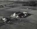
| Date: | 10 05 1948 |
|---|---|
| Description: | Aerial photograph of the Baumgartner Dairy Farm, one half mile east of Three Lakes, WI. |

| Date: | 1921 |
|---|---|
| Description: | A plat map of Mequon, Wisconsin. Text at top reads: "T. 9N. R.21 E MEQUON T. 9N. R.22 E." |
If you didn't find the material you searched for, our Library Reference Staff can help.
Call our reference desk at 608-264-6535 or email us at: