Filter: Categories of Wisconsin Historical Images
Filter: County of Rock
Filter: Subject of cemeteries
Filter: Categories of Wisconsin Historical Images
Filter: County of Rock
Filter: Subject of cemeteries

| Date: | 1881 |
|---|---|
| Description: | Bird's-eye map of Milton Junction. |

| Date: | 1955 |
|---|---|
| Description: | This map includes a street index and shows municipal golf course, parks, schools, cemeteries, Janesville County Club, and industrial sites. The back of the... |

| Date: | 1873 |
|---|---|
| Description: | This map shows land ownership by name, local streets, railroads, parks, college grounds, schools, cemeteries, and part of Rock River. The upper left margin... |

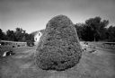
| Date: | 1979 |
|---|---|
| Description: | A specimen of Pinus sylvestris, judged to be the largest of its type in Wisconsin, standing in the Cooksville Cemetery. Smaller trees and other flow... |
If you didn't find the material you searched for, our Library Reference Staff can help.
Call our reference desk at 608-264-6535 or email us at: