 Filter: Categories of Wisconsin Historical Images
Filter: County of Milwaukee
Filter: Year of 1800-1899
Filter: Year of 1890-1899
Filter: Type of Map or Atlas
Filter: Categories of Wisconsin Historical Images
Filter: County of Milwaukee
Filter: Year of 1800-1899
Filter: Year of 1890-1899
Filter: Type of Map or Atlas

| Date: | 1898 |
|---|---|
| Description: | Bird's-eye map of Milwaukee with prominent streets and buildings identified. Taken from City Hall Tower. |

| Date: | 1892 |
|---|---|
| Description: | Color bird's-eye map of Wauwatosa, looking east toward Milwaukee and Lake Michigan. Predominantly green with cream colored roadways, with six land plots ow... |

| Date: | 1898 |
|---|---|
| Description: | Bird's-eye map, looking west from shoreline on Lake Michigan of Milwaukee to Golden Lake in Waukesha County, with Kenosha and Fox Point at bottom corners, ... |

| Date: | 1894 |
|---|---|
| Description: | Sanborn map of a portion of Milwaukee, including St. Clair and Bishop and Potter Avenues. There is an inset for the South Side Wood Working Co. |

| Date: | 1894 |
|---|---|
| Description: | Sanborn Map of the Illinois Steel Co. Bay View Works in Milwaukee. |

| Date: | 1891 |
|---|---|
| Description: | A hand-colored map of Milwaukee County, Wisconsin that shows the township and range system, sections, towns, roads, railroads and rail stations, cities and... |

| Date: | 1896 |
|---|---|
| Description: | A map of Milwaukee County, Wisconsin that shows the township and range system, sections, towns, roads, railroads and rail stations, cities and villages, po... |

| Date: | 1890 |
|---|---|
| Description: | Map of Milwaukee as remembered by "Dr Enoch Chase, U.B. Smith & Others." Represented are major roads, lowlands, trails, homesteads, and lots. Map depicts t... |
| Date: | 1890 |
|---|---|
| Description: | Map of Merrill Estate property for sale and sold. Map reads: "Merrill Estate property (colored) lots marked X are sold for terms & prices inquire of S.H. C... |

| Date: | 1891 |
|---|---|
| Description: | This maps has an index of depots, hotels, prominent institutions and buildings, churches, and places of amusement. The map was removed from an unidentified... |

| Date: | 1891 |
|---|---|
| Description: | Map of a proposed subdivision. Map reads: "United States Investment Association SUBDIVISION No. 1 In S.W. 1/4 Sec. 33, Town 8, Range 22 East. Is situated a... |

| Date: | 1896 |
|---|---|
| Description: | Map highlighting parks and other points of interest in Milwaukee. |
| Date: | 1893 |
|---|---|
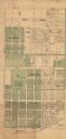
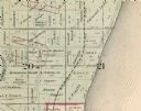
| Description: | Detail of a Milwaukee County map that shows sections 20 and 21 at Range 22 East, Township 8 North. |

| Date: | 1894 |
|---|---|
| Description: | Sanborn map of Milwaukee, with the Milwaukee River on the left, and Water Street in the center. There are two iron draw bridges over the river. |

| Date: | 1891 |
|---|---|
| Description: | This map shows railroads, street railways, roads, wards, block numbers, parks, and one mile concentric circles indicating distance from Post Office. Also i... |

| Date: | 1892 |
|---|---|
| Description: | This map shows water pipes, hydrants, stop cocks, check valves, fire cysterns, and manholes. Also shown are block numbers, streets, railroads, parks, cemet... |

| Date: | 1892 |
|---|---|
| Description: | This map shows schools, engine houses, railroads, street railways, wards, parks, cemeteries, block numbers, a street index, explanations, and general refer... |

| Date: | 1893 |
|---|---|
| Description: | This map covers west to Wauwatosa, north to North Milwaukee, and south to South Milwaukee and shows street railways, city limits, parks, roads, railroads, ... |

| Date: | 1893 |
|---|---|
| Description: | This map shows city wards, block numbers, parks, cemeteries, roads, railroads, selected buildings, and Lake Michigan. Also included are indexes to streets,... |

| Date: | 1894 |
|---|---|
| Description: | This map shows railroads, street railways, roads, wards, block numbers, parks, Lake Michigan, and one mile concentric circles indicating distance from the ... |
If you didn't find the material you searched for, our Library Reference Staff can help.
Call our reference desk at 608-264-6535 or email us at: