 Filter: Categories of Wisconsin Historical Images
Filter: County of Manitowoc
Filter: Type of Map or Atlas
Filter: Subject of streets
Filter: Categories of Wisconsin Historical Images
Filter: County of Manitowoc
Filter: Type of Map or Atlas
Filter: Subject of streets

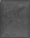
| Date: | 01 1899 |
|---|---|
| Description: | Shows lot and block numbers, railroads, ward boundaries, and some landownership. Includes public building index. |

| Date: | 1960 |
|---|---|
| Description: | This map is a cadastral map and shows block and lot numbers and dimensions, additions, streets, railroad, and Kiel Municipal Cemetery. The bottom right mar... |

| Date: | 1905 |
|---|---|
| Description: | This map shows a plat of the city, local streets, railroads, public buildings, local businesses, and parts of the Manitowoc River and Lake Michigan. Relief... |

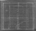
| Date: | |
|---|---|
| Description: | This plat map shows numbered blocks and lots, wards, local streets, railroads, cemeteries, buildings, land ownership by name, and parts of Manitowoc River ... |

| Date: | 1925 |
|---|---|
| Description: | This map shows a plat of the city, local streets, railroads, public buildings, local businesses, and parts of the Manitowoc River and Lake Michigan. Relief... |

| Date: | 1856 |
|---|---|
| Description: | This map shows the Manitowoc River, Lake Michigan, streets, and buildings. Relief is shown by hachures and soundings are in feet and decimals of a foot. Th... |

| Date: | 09 1853 |
|---|---|
| Description: | This map shows streets, docks, warehouses, and piers near the harbor. The Manitowoc River and Lake Michigan are labeled. Depths are indicated by soundings ... |

| Date: | 1854 |
|---|---|
| Description: | This map shows streets, docks, warehouses, and piers near the harbor. Relief is shown by hachures and depths are shown by soundings and isolines. Lake Mich... |

| Date: | 1856 |
|---|---|
| Description: | This map shows streets, piers, and wharves. Lake Michigan, the Manitowoc River, and select buildings are labeled. Relief is shown by hachures and sounding... |

| Date: | 1874 |
|---|---|
| Description: | This map shows piers, streets, the Manitowoc River and shore lines of 1856, 1869, 1873 and 1874. The top margin reads; "Soundings taken 1974." Written in i... |

| Date: | 1870 |
|---|---|
| Description: | This blueprint map shows lot and block numbers, streets, and right of way for the Two Rivers Branch railroad. The map covers land west to sections 22 and 2... |
| Date: | 1900 |
|---|---|
| Description: | This map shows a paper city located in section 23, township 17 north, range 22 east; area now occupied by the community of Spring Valley in Manitowoc Count... |
| Date: | 1900 |
|---|---|
| Description: | Map shows a paper city located in Manitowoc County, on the (unlabeled) Devils River. Includes land parcels, blocks, and street names. The back of the map i... |
If you didn't find the material you searched for, our Library Reference Staff can help.
Call our reference desk at 608-264-6535 or email us at: