Filter: Categories of Wisconsin Historical Images
Filter: County of Lincoln
Filter: Type of Map or Atlas
Filter: Subject of lakes
Filter: Categories of Wisconsin Historical Images
Filter: County of Lincoln
Filter: Type of Map or Atlas
Filter: Subject of lakes

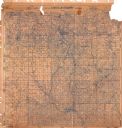
| Date: | 1915 |
|---|---|
| Description: | This 1915 map of Lincoln County, Wisconsin, shows the township and range grid, towns, cities and villages, lakes and streams, residences, churches, school ... |

| Date: | 1926 |
|---|---|
| Description: | A map of Lincoln County, Wisconsin that shows the township and range grid, towns, cities and villages, lakes and streams, residences, churches, school hous... |
| Date: | 1872 |
|---|---|
| Description: | Shows what is currently Lincoln County and portions of Vilas, Oneida, Iron, and Langlade counties. Includes manuscript annotations of marked land tracts. |

| Date: | 1982 |
|---|---|
| Description: | This standard U.S.G.S. topographic map was annotated by civil engineer and railroad historian James P. Kaysen to show the location of existing and defunct ... |

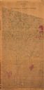
| Date: | 1902 |
|---|---|
| Description: | A plat map of Lincoln County showing Township 34 North, Range 8 East. |

| Date: | |
|---|---|
| Description: | A photocopy of the T.34N, R.8E portion of a map of Lincoln County. |
If you didn't find the material you searched for, our Library Reference Staff can help.
Call our reference desk at 608-264-6535 or email us at: