| Date: | 1858 |
|---|---|
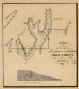
| Description: | This 1858 map shows mine shafts, lead veins, and topography on the property of the New Diggings and Shullsburg Mining Company in Section 5 of Township 1 N.... |

| Date: | 1850 |
|---|---|
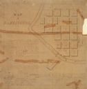
| Description: | Ink on paper. Shows local streets and Pekatonika River. "John M. Keep, proprietor. "Original plat of Darlington as surveyed by Richardson on June 14, 1850.... |

| Date: | 1855 |
|---|---|
| Description: | This map is ink, pen, and watercolor on paper and shows plat of the town, local streets, lots by number, U.S. subdivisions in red lines, Mineral Point Rail... |

| Date: | 1852 |
|---|---|
| Description: | Sixth plate daguerreotype of Azel Parkhurst Ladd (1811-1854). Ladd was the Wisconsin state superintendent of public instruction in 1852. Oval-framed quarte... |

| Date: | 1857 |
|---|---|
| Description: | This map shows lot numbers, lot dimensions (in chains and links), and a mineral reservation for use of proprietors. Includes certifications signed in Sept.... |
If you didn't find the material you searched for, our Library Reference Staff can help.
Call our reference desk at 608-264-6535 or email us at: