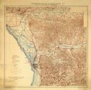
| Date: | 1900 |
|---|---|
| Description: | A map of La Crosse County, Wisconsin, showing and identifying the townships and section numbers, towns, cities and villages, landowners, rivers, railroads,... |

| Date: | 1931 |
|---|---|
| Description: | Relief shown by contours and spot heights. Maps shows United States, state, county and local highways and roads, schools, North Bend, creeks, lakes, rivers... |

| Date: | |
|---|---|
| Description: | Hand-colored elevated view from hill of Lake Como. People are in a boat in the lake. Caption reads: "Lake Como, near La Crosse, Wis." |

| Date: | 1942 |
|---|---|
| Description: | Black and white aerial view of La Crosse and the Mississippi River, including Riverside Park, the Black River and La Crosse River. |

| Date: | 1955 |
|---|---|
| Description: | A motorboat on Lake Neshonoc is speeding toward the public landing, where there is a car parked and a small group of people has gathered. A man in a swimmi... |

| Date: | 01 13 1907 |
|---|---|
| Description: | Text on front reads: "Neshonoc Falls, West Salem, Wis." The Neshonoc Dam, powerhouse and spillway on the La Crosse River. The powerhouse was built after 18... |
If you didn't find the material you searched for, our Library Reference Staff can help.
Call our reference desk at 608-264-6535 or email us at: