 Filter: Categories of Wisconsin Historical Images
Filter: County of Kenosha
Filter: Type of Map or Atlas
Filter: Subject of roads
Filter: Subject of michigan, lake
Filter: Categories of Wisconsin Historical Images
Filter: County of Kenosha
Filter: Type of Map or Atlas
Filter: Subject of roads
Filter: Subject of michigan, lake

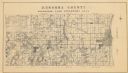
| Date: | 1946 |
|---|---|
| Description: | A map showing the roads, railroads, towns, cities and villages, streams and lakes, airports, schools, churches, cemeteries, and golf courses in Kenosha Cou... |
| Date: | 1934 |
|---|---|
| Description: | A land inventory map of Kenosha County. The top left features a legend of "Land Cover" and "Roads and Other Improvements". Lake Michigan is labelled to the... |

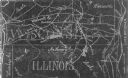
| Date: | 1855 |
|---|---|
| Description: | This map has relief shown by hachures and soundings and shows local streets, proposed roads, railroads, bridge wharfs, basin, north arm, and west arm of Ke... |

| Date: | 1959 |
|---|---|
| Description: | This map shows public access sites, public beaches and parks, other public shorelines, boat liveries, public hunting and fishing grounds, railroads, roads,... |
| Date: | 1954 |
|---|---|
| Description: | This photocopy map shows a early sketch of the settlement Southport. Rivers, lakes, other settlements, county boundaries, and roads are labeled. A portion ... |

| Date: | 1926 |
|---|---|
| Description: | This blueprint map shows the harbor at Kenosha, also showing buildings surrounding the harbor, roads, and railroads. Original caption in red states: "Areas... |
If you didn't find the material you searched for, our Library Reference Staff can help.
Call our reference desk at 608-264-6535 or email us at:
