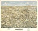
| Date: | 1869 |
|---|---|
| Description: | Birds-eye drawing of Boscobel, Grant County, depicts street names and street layouts, houses, rivers and trees. A reference key at the bottom of the map sh... |

| Date: | 1875 |
|---|---|
| Description: | Bird's-eye map of Platteville. |

| Date: | |
|---|---|
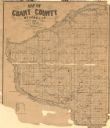
| Description: | Plan of township no. 3 north, range no. 5 west of the 4th principal meridian. |

| Date: | 1835 |
|---|---|
| Description: | Plat for a proposed Sinsinawa City (never built), in Grant County, Wis. When it became clear in the mid-1830s that Wisconsin Territory would be established... |

| Date: | 1857 |
|---|---|
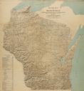
| Description: | Relief shown by hachures. "Lith. of Ed. Mendel, Chicago." Shows townships and sections, rivers, roads, railroads, houses, flour mills, saw mills, furnaces... |

| Date: | 1972 |
|---|---|
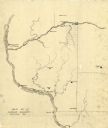
| Description: | Ink on tracing paper. This map shows rivers, Prairie du Chien, site of Fort Crawford, Excelsior, Fort Andrew, Boscobel, Blue River, Orion, Muscoda, Castle ... |

| Date: | 1960 |
|---|---|
| Description: | This street map was likely given out by Mound City Bank and features a legend of points of interest and a street index. Streets are labeled as is the Round... |

| Date: | 1906 |
|---|---|
| Description: | This topographical map shows the Little Platte River, shafts, test-pits, old workings, contour lines of Galena limestone elevation, railroads, and building... |
If you didn't find the material you searched for, our Library Reference Staff can help.
Call our reference desk at 608-264-6535 or email us at: