| Date: | 1899 |
|---|---|
| Description: | Map of Door County with inset photograph of Sturgeon Bay City. |

| Date: | 1941 |
|---|---|
| Description: | This 1941 tourist map of Washington Island, Wisconsin, shows points of interest and places of business. Some information is shown pictorially. Rock, Hog, D... |

| Date: | 1860 |
|---|---|
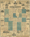
| Description: | This map of Dodge County, Wisconsin, shows the township and range grid, towns, sections, cities and villages, railroads, roads, property owners and acreage... |

| Date: | 1959 |
|---|---|
| Description: | This map includes directories, illustrations, and an inset location map and also covers Rock, Hog, Detroit and Plum islands. |

| Date: | 1860 |
|---|---|
| Description: | Inset from Map of Dodge County. Caption reads: "Farmer's Brewery, (Beaver Dam) Aman & Schutte, Proprs." A sign on the building reads: "Farmer's Brewery by ... |
If you didn't find the material you searched for, our Library Reference Staff can help.
Call our reference desk at 608-264-6535 or email us at: