Filter: Categories of Wisconsin Historical Images
Filter: County of Dane
Filter: Subject of shorelines
Filter: Subject of forests and forestry
Filter: Categories of Wisconsin Historical Images
Filter: County of Dane
Filter: Subject of shorelines
Filter: Subject of forests and forestry

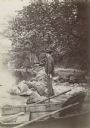
| Date: | 1910 |
|---|---|
| Description: | Big spring on Lake Mendota Drive. [Merrill Springs or sometimes Merrill's Spring] |
| Date: | |
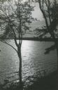
|---|---|
| Description: | Evening view of Capitol from across Lake Mendota. |

| Date: | 01 13 1937 |
|---|---|
| Description: | Sketch map of Township 7 North, Range 9 East, created for the Land Economic Inventory (Bordner Survey). The map shows Picnic Point and the Lake Mendota sho... |
If you didn't find the material you searched for, our Library Reference Staff can help.
Call our reference desk at 608-264-6535 or email us at: