Filter: Categories of Wisconsin Historical Images
Filter: County of Dane
Filter: Subject of ponds
Filter: Subject of roads
Filter: Categories of Wisconsin Historical Images
Filter: County of Dane
Filter: Subject of ponds
Filter: Subject of roads

| Date: | 1873 |
|---|---|
| Description: | A map of the township of Montrose from the "Atlas of Dane County." |

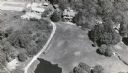
| Date: | 1928 |
|---|---|
| Description: | View down valley towards the back of the Lutheran Church and cemetery. Houses and barns are in the valley below, and more hills are in the far background. ... |

| Date: | 1931 |
|---|---|
| Description: | A plat map of Springfield, Wisconsin. |
If you didn't find the material you searched for, our Library Reference Staff can help.
Call our reference desk at 608-264-6535 or email us at: