 Filter: Categories of Wisconsin Historical Images
Filter: County of Dane
Filter: Subject of parks
Filter: Subject of forests and forestry
Filter: Categories of Wisconsin Historical Images
Filter: County of Dane
Filter: Subject of parks
Filter: Subject of forests and forestry

| Date: | 1930 |
|---|---|
| Description: | Aerial view of Hoyt Park including the surrounding neighborhoods. Resurrection Cemetery can be seen at the upper right of the image. |
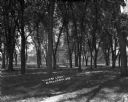
| Date: | |
|---|---|
| Description: | View down dirt path through a wooded area. Beyond the trees are houses and buildings. |

| Date: | 1970 |
|---|---|
| Description: | Color coded map. Legend in the top left hand corner reads: "EXISTING AIRPORT PAVEMENT" (purple), "FUTURE 5-YEAR DEVELOPMENT" (bright pink), "ULTIMATE AIRPO... |
If you didn't find the material you searched for, our Library Reference Staff can help.
Call our reference desk at 608-264-6535 or email us at: