| Date: | 1942 |
|---|---|
| Description: | Aerial view of Oscar Mayer & Company, 910 Mayer Avenue at Packers Avenue. Shows stock yards, railroad cars and automobile parking lot. Also shows C.E. & P.... |

| Date: | |
|---|---|
| Description: | Elevated view of Mount Horeb from the water tower. Homes and commercial structures dominate the left side, while farmland and newly-developed tracts are to... |

| Date: | 1913 |
|---|---|
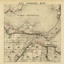
| Description: | This photocopy map shows plots with owners' names, land use both commercial and agricultural, and lot outlines on University land. Lake Mendota is labeled ... |

| Date: | 1924 |
|---|---|
| Description: | A map of the Madison Township, T7N R9E including Lake Mendota showing the location of Ho Chunk encampments and effigy mounds. |
If you didn't find the material you searched for, our Library Reference Staff can help.
Call our reference desk at 608-264-6535 or email us at: