 Filter: Categories of Wisconsin Historical Images
Filter: County of Dane
Filter: Subject of formations (geology)
Filter: Type of Map or Atlas
Filter: Categories of Wisconsin Historical Images
Filter: County of Dane
Filter: Subject of formations (geology)
Filter: Type of Map or Atlas

| Date: | 1900 |
|---|---|
| Description: | Hydrographic map of Lake Mendota and it's adjacent topography. Prepared from surveys made by civil engineering students, University of Wisconsin, classes 1... |

| Date: | 1867 |
|---|---|
| Description: | This 1867 manuscript map by Increase Lapham shows the topography and geology of the Blue Mounds region in the Town of Brigham in Iowa County and the towns ... |
| Date: | 06 08 1908 |
|---|---|
| Description: | Pen-and-ink on paper. Shows vicinity of Washburn Observatory and University Hall at the University of Wisconsin-Madison. Relief shown by contours and spot ... |

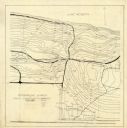
| Date: | 1902 |
|---|---|
| Description: | This map is watercolor and pen on paper and relief shown by contours. The map reads: "Contour interval 10 feet." Shown on the map are geological features a... |
If you didn't find the material you searched for, our Library Reference Staff can help.
Call our reference desk at 608-264-6535 or email us at: