Search the Wisconsin Historical Society's collections

Searching for

Refine by

Results 1-20 of 330

Map or Atlas

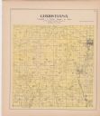
Plat Map of Christiana

Date: 1873
Description: A plat map of the town of Christiana.
Map or Atlas

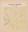
Plat Map of Pleasant Springs

Date: 1873
Description: A plat map of the town of Pleasant Springs.
Map or Atlas

A Plat Map of Stoughton

Date: 1899
Description: A plat map of the city of Stoughton.
Map or Atlas

Plat Map of Dunn

Date: 1899
Description: A plat map of the township of Dunn.
Map or Atlas

Plat Map of Dunkirk

Date: 1899
Description: A plat map of the township of Dunkirk.
Map or Atlas

Plat Map of Christiana

Date: 1899
Description: A plat map of the township of Christiana.
Map or Atlas

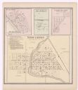
A Plat Map of Stoughton, Clifton, Deanville, and Cross Plains

Date: 1873
Description: A page showing four plat maps: Stoughton, Clifton, Deanville, and Cross Plains.
Map or Atlas

Plat Map of Dunkirk

Date: 1873
Description: A plat map of the town of Dunkirk.
Map or Atlas

Plat Map of Dunn

Date: 1873
Description: A plat map of the town of Dunn.
Map or Atlas

A Plat Map of Albion

Date: 1873
Description: A plat map of the town of Albion.
Map or Atlas

Plat Map of Rutland

Date: 1873
Description: A plat map of the town of Rutland.
Map or Atlas

Plat Map of Albion

Date: 1899
Description: A plat map of the township of Albion.
Map or Atlas

Map of Deerfield

Date: 1873
Description: A plat map of Deerfield.
Map or Atlas

Sanborn Map of Waunakee

Date: 10 1894
Description: A Sanborn Fire Insurance Map of Waunakee.
Map or Atlas

You're Always Near Fun in Madison

Date: 
Description: This map of Madison is also a brochure of activities for vacationers in the area. Includes indexes and some points of interest shown pictorially.
Map or Atlas

Visit Madison Wisconsin Map

Date: 
Description: The cover of a map which is titled: "Visit Madison Wisconsin the Capital of Vacationland". The cover lists various places to visit in the city.
Map or Atlas

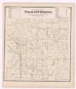
Plat Map of Pleasant Springs

Date: 1899
Description: A plat map of Pleasant Springs in Dane County.
Map or Atlas

Westport Plat Map

Date: 1873
Description: A plat map of Westport.
Map or Atlas

Dane County Plat Map

Date: 1899
Description: A plat map of Burke, Cottage Grove, McFarland, Waunakee, Quarry Town, Klevenville, and Vilas.
Map or Atlas

Sanborn Map of Madison

Date: 1908
Description: A Sanborn map including a portion of the East Johnson Street and East Gorham Street neighborhood.

Have Questions?

If you didn't find the material you searched for, our Library Reference Staff can help.

Call our reference desk at 608-264-6535 or email us at: