 Filter: Categories of Wisconsin Historical Images
Filter: County of Clark
Filter: Subject of lakes
Filter: Categories of Wisconsin Historical Images
Filter: County of Clark
Filter: Subject of lakes
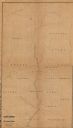
| Date: | 1873 |
|---|---|
| Description: | This 1873 map shows Clark County, Wisconsin, as well as the portion of Taylor County that was then part of Clark. The township and range grid, sections, ra... |

| Date: | 1880 |
|---|---|
| Description: | This 1880 map of Clark County, Wisconsin, shows the township and range grid, towns, sections, cities and villages, railroads, roads, rivers and lakes, dams... |
| Date: | 1914 |
|---|---|
| Description: | This early-20th century map of Clark County, Wisconsin, shows the township and range grid, towns, sections, cities and villages, property owners and acreag... |

| Date: | 1933 |
|---|---|
| Description: | Blue line copy on paper with manuscript additions in color. Shows boundaries of zoned areas, Wisconsin historical lands in zoned areas, county lands outsid... |
If you didn't find the material you searched for, our Library Reference Staff can help.
Call our reference desk at 608-264-6535 or email us at: