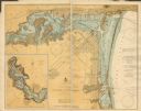
| Date: | 1925 |
|---|---|
| Description: | This map of Howard's Bay located at the Duluth Superior Harbor is a close view of Connors Point and shows a key to prevailing winds and water depth measure... |

| Date: | 1901 |
|---|---|
| Description: | This map shows streets, industrial buildings, a portion of Lake Superior and other lakes, bays, and rivers in portions of Duluth and Superior. Relief is sh... |
If you didn't find the material you searched for, our Library Reference Staff can help.
Call our reference desk at 608-264-6535 or email us at: