| Date: | 1961 |
|---|---|
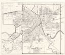
| Description: | This map shows wards as well as proposed future streets, lot and block numbers, additions, and some landownership. The Sheboygan River is labeled. |

| Date: | 10 1978 |
|---|---|
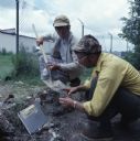
| Description: | Two men are kneeling on the ground. One man is holding a shovel while the other man is scooping dirt from the shovel into a glass jar. They are measuring P... |
If you didn't find the material you searched for, our Library Reference Staff can help.
Call our reference desk at 608-264-6535 or email us at: