| Date: | 1908 |
|---|---|
| Description: | Colored map showing a panoramic view of Madison in great detail. The Wisconsin State Capitol is located at the center, with Lake Mendota in the background ... |

| Date: | 1910 |
|---|---|
| Description: | Map of Dane County rural delivery in Madison and the town of Westport. |

| Date: | 1916 |
|---|---|
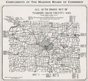
| Description: | Map of all automobile roads out of Madison, compliments of the Madison Board Of Commerce. |

| Date: | 1910 |
|---|---|
| Description: | Map of the general plan of the district of the Four Lakes. |

| Date: | 1949 |
|---|---|
| Description: | Color bird's-eye map of the University of Wisconsin-Madison as it was midcentury, with two co-eds, several photographs of campus landmarks around edges, an... |

| Date: | 1948 |
|---|---|
| Description: | Colored map with black and white photographic images in wedges at right and left sides. Map extends from Camp Randal stadium at bottom left corner, to Lake... |

| Date: | 1929 |
|---|---|
| Description: | Bird's-eye map of the University of Wisconsin-Madison on Lake Mendota. Black and white drawing with named streets and numbered buildings without location ... |

| Date: | 1920 |
|---|---|
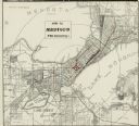
| Description: | A map of Madison and the vicinity. Red lines show the street railway. |

| Date: | 1904 |
|---|---|
| Description: | This map shows a plat of the east part of the city, numbered blocks and lots, some landownership, local streets, roads, railroads, wards by number, parks, ... |

| Date: | 1920 |
|---|---|
| Description: | Map of the Nakoma neighborhood including the proposed golf grounds. |

| Date: | 1904 |
|---|---|
| Description: | This map shows a plat of the west part of the city, numbered blocks and lots, some landownership, local streets, roads, railroads, wards by number, parks, ... |

| Date: | 1900 |
|---|---|
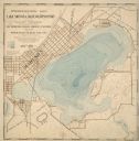
| Description: | Hydrographic map of Lake Mendota and it's adjacent topography. Prepared from surveys made by civil engineering students, University of Wisconsin, classes 1... |

| Date: | 1910 |
|---|---|
| Description: | Scale: 1:62500. Topography by Robert Muldrow. Surveyed in 1904. Edition of Aug. 1906, reprinted in 1910. |

| Date: | 1904 |
|---|---|
| Description: | A map showing the design for a park fronting on Lake Monona Bay. (Now called Brittingham Park) taken from between pages 44 & 45 of the 1905 Madison Park a... |

| Date: | 1911 |
|---|---|
| Description: | Map of the west part of the city of Madison. |

| Date: | 1959 |
|---|---|
| Description: | University of Wisconsin-Madison campus. Numbers in circles identify buildings across campus with the building index. Black arrows point out important infor... |

| Date: | 04 1945 |
|---|---|
| Description: | Planting plan for Glenwood Children's Park, designed by Jens Jensen. Graphite pencil and colored pencil on tissue (overlays pencil plan) Original drawing... |

| Date: | 1900 |
|---|---|
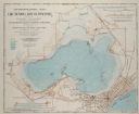
| Description: | A hydrographic map of Lake Monona and the adjacent topography. |
If you didn't find the material you searched for, our Library Reference Staff can help.
Call our reference desk at 608-264-6535 or email us at: