| Date: | 1911 |
|---|---|
| Description: | Map of the west part of the city of Madison. |

| Date: | |
|---|---|
| Description: | Wisconsin Memorial Hospital with a key to buildings in the upper left. Indian mounds are marked on the site. Arthur Peabody was the state architect for th... |

| Date: | 1959 |
|---|---|
| Description: | University of Wisconsin-Madison campus. Numbers in circles identify buildings across campus with the building index. Black arrows point out important infor... |

| Date: | 04 1945 |
|---|---|
| Description: | Planting plan for Glenwood Children's Park, designed by Jens Jensen. Graphite pencil and colored pencil on tissue (overlays pencil plan) Original drawing... |

| Date: | 1900 |
|---|---|
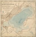
| Description: | A hydrographic map of Lake Monona and the adjacent topography. |

| Date: | 1941 |
|---|---|
| Description: | Hand-drawn, watercolor and ink, map of Lake Mendota. Locations and many small figures appear around the shore with explanations referring to Indian legends... |

| Date: | 1906 |
|---|---|
| Description: | Hand-drawn topographical map of the Turville Estate. |

| Date: | 1906 |
|---|---|
| Description: | Topographical map of Turville Point and lands to the South to Nine Springs Creek. |

| Date: | 1844 |
|---|---|
| Description: | Part of a series of local maps, showing a number of burial mounds in the shape of animals near Madison, Wisconsin along military road. The maps also show d... |

| Date: | 1892 |
|---|---|
| Description: | This map oriented with north to the upper left shows railroads, creeks, post offices, smaller lakes, Lake Mendota, Lake Monona, Lake Wingra, Lake Waubesa, ... |

| Date: | 1911 |
|---|---|
| Description: | A map of the Racine, Kenosha, and portions of Milwaukee counties, that shows the townships in Racine and Kenosha, and the townships of Brookfield, New Berl... |

| Date: | 1974 |
|---|---|
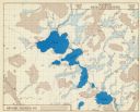
| Description: | This 1974 map is a reproduction of the original survey maps of the Four Lakes region of Dane County, Wisconsin. It shows sections, lakes, rivers, wetlands,... |

| Date: | 1899 |
|---|---|
| Description: | These two maps of Madison and the Four Lakes region show the site of the Teachers Country Club on Lake Monona, the lakes and the Catfish or Yahara River, f... |

| Date: | 1909 |
|---|---|
| Description: | This 1909 bird's-eye view of Madison and the surrounding Four Lakes region shows roads, railroads, selected buildings in Madison, and points of interest ar... |

| Date: | 1948 |
|---|---|
| Description: | This 1948 map shows contour and spot depths in Lake Wingra in Madison, Wisconsin. The shore outline is based on a 1940 aerial photograph. |

| Date: | 1836 |
|---|---|
| Description: | Map shows rivers, creeks, roads, trails, mills, and town of Madison. Includes significant manuscript annotations; Sheet 1 is watercolor on lithographed map... |

| Date: | 1854 |
|---|---|
| Description: | Shows street grid, sections in adjacent townships, routes of railroads and projected railroads, post offices, and creeks. Table of references identifies ma... |

| Date: | 1913 |
|---|---|
| Description: | This map shows city wards and government buildings. The map is oriented with north to upper right. |

| Date: | 1914 |
|---|---|
| Description: | Shows lot numbers and dimensions; covers portion of the neighborhood currently known as Shorewood Hills. Includes red annotations showing houses and sold l... |

| Date: | 1914 |
|---|---|
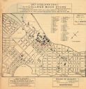
| Description: | Includes index of University of Wisconsin buildings, churches, and public buildings. Top of Map reads: '"GET A SQUARE DEAL" AT THE COLLEGE BOOK STORE SHOWN... |
If you didn't find the material you searched for, our Library Reference Staff can help.
Call our reference desk at 608-264-6535 or email us at: