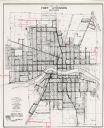
| Date: | 1920 |
|---|---|
| Description: | Shows ward boundaries, corporation limits, plat of town, land ownership by name, local streets, parks, railroads, and parts of Rock River. Wards appear in ... |

| Date: | 1947 |
|---|---|
| Description: | Lower left hand corner features a legend. "Drawn 1938, revised 1947." Shows water mains, hydrants, corporation limits, city ward divisions, fire proof buil... |

| Date: | 1976 |
|---|---|
| Description: | Includes index of streets and of local businesses. Shows location of Citizens State Bank, roads, highways, railroads, parks, cemeteries, and city sanitary ... |
If you didn't find the material you searched for, our Library Reference Staff can help.
Call our reference desk at 608-264-6535 or email us at: