 Filter: Categories of Wisconsin Historical Images
Filter: Community of Fond du Lac
Filter: Type of Map or Atlas
Filter: Creator Name of Unknown
Filter: Categories of Wisconsin Historical Images
Filter: Community of Fond du Lac
Filter: Type of Map or Atlas
Filter: Creator Name of Unknown
| Date: | |
|---|---|
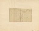
| Description: | Map shows rivers and acreages in part of Fond du Lac township and Fond du Lac, Wisconsin. |

| Date: | 1840 |
|---|---|
| Description: | Shows plat of town, local streets, Fond du Lac River, and part of Lake Winnebago. |

| Date: | 1956 |
|---|---|
| Description: | Includes street index. Shows local streets, parks, highways, railroads, Fond du Lac River, and part of lake Winnebago. Also includes text on points of inte... |

| Date: | 1800 |
|---|---|
| Description: | Ink and watercolor on tracing paper. Shows plat of town, local streets, Fond du Lac River, and part of Lake Winnebago. |
If you didn't find the material you searched for, our Library Reference Staff can help.
Call our reference desk at 608-264-6535 or email us at: