 Filter: Categories of Wisconsin Historical Images
Filter: Creator Name of Unknown
Filter: County of Waukesha
Filter: Type of Map or Atlas
Filter: Categories of Wisconsin Historical Images
Filter: Creator Name of Unknown
Filter: County of Waukesha
Filter: Type of Map or Atlas

| Date: | 1882 |
|---|---|
| Description: | This manuscript map from 1882 shows land use and land for sale in a portion of the Town of Pewaukee, Waukesha County, Wisconsin. Woods, marshland, springs,... |

| Date: | |
|---|---|
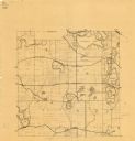
| Description: | This 19th century manuscript map of the Town of Oconomoc, Waukesha County, Wisconsin, is drawn on a printed township grid. It shows landownership and lakes... |

| Date: | 1953 |
|---|---|
| Description: | Map shows landownership and acreages, roads, and railroads in the Town of Waukesha and part of the city of Waukesha, Waukesha County, Wisconsin. |

| Date: | 1846 |
|---|---|
| Description: | This map of Prairieville, later renamed Waukesha, is ink and pencil on paper and shows the Fox River, a plat of village, and lot owners. |
| Date: | 1925 |
|---|---|
| Description: | This map shows township sections, roads, railroads, and lakes. The map also features extensive manuscript annotations noting landownership in pencil. Stamp... |
| Date: | 1950 |
|---|---|
| Description: | This map is revised by McMahon Engineering Company, Menasha, Wisconsin and shows plat of town, local streets, concrete monument, iron stake, government sto... |

| Date: | 1970 |
|---|---|
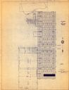
| Description: | This map shows lots, house numbers, institutional buildings, and cemeteries. The bottom of the map includes indexes to streets, points of interest and inst... |

| Date: | 1934 |
|---|---|
| Description: | This map shows the area as it appeared in 1848 and includes buildings, land use, and roads with distances to nearby locations. The upper right corner reads... |
If you didn't find the material you searched for, our Library Reference Staff can help.
Call our reference desk at 608-264-6535 or email us at:

