 Filter: Categories of Wisconsin Historical Images
Filter: Creator Name of Sanborn-Perris Map Company
Filter: Subject of land
Filter: Subject of rivers
Filter: Categories of Wisconsin Historical Images
Filter: Creator Name of Sanborn-Perris Map Company
Filter: Subject of land
Filter: Subject of rivers

| Date: | 05 1926 |
|---|---|
| Description: | Section 1 of a Sanborn map of Osceola. |

| Date: | 05 1926 |
|---|---|
| Description: | Section 2 of a Sanborn map of Osceola. |
| Date: | 11 1894 |
|---|---|
| Description: | A detail of a Sanborn map of Grafton which includes the Milwaukee River. |

| Date: | 10 1884 |
|---|---|
| Description: | Sanborn insurance map of Black River Falls covering the area bordered by the Black River on the East, 3rd Street on the West, Johnson Street on the North, ... |

| Date: | 09 1884 |
|---|---|
| Description: | Sanborn map of Fort Atkinson including Barrie, Germany, and North Water Streets. |

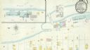
| Date: | 09 1891 |
|---|---|
| Description: | Sanborn map of Hurley, featuring the Village of Gile and the Montreal River Lumber Company. |

| Date: | 1898 |
|---|---|
| Description: | Sanborn map of Hurley featuring the Village of Gile. |
If you didn't find the material you searched for, our Library Reference Staff can help.
Call our reference desk at 608-264-6535 or email us at:

