Filter: Categories of Wisconsin Historical Images
Filter: Creator Name of Paetzold, C. H.
Filter: Subject of human settlements
Filter: Categories of Wisconsin Historical Images
Filter: Creator Name of Paetzold, C. H.
Filter: Subject of human settlements

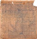
| Date: | 1915 |
|---|---|
| Description: | This 1915 map of Lincoln County, Wisconsin, shows the township and range grid, towns, cities and villages, lakes and streams, residences, churches, school ... |

| Date: | 1926 |
|---|---|
| Description: | A map of Lincoln County, Wisconsin that shows the township and range grid, towns, cities and villages, lakes and streams, residences, churches, school hous... |

| Date: | 1914 |
|---|---|
| Description: | This 1914 map of Price County, Wisconsin, shows land for sale by the Good Land Company and Dewitt van Ostrand of Phillips. Also shown are the township and ... |

| Date: | 1917 |
|---|---|
| Description: | This 1917 map of Ashland County, Wisconsin, shows the township and range system, towns, sections, cities and villages, the Bad River Indian Reservation, ra... |

| Date: | 1918 |
|---|---|
| Description: | This 1918 map of Chippewa County, Wisconsin, shows the township and range grid, towns, sections, cities and villages, rural residences, churches, schools, ... |

| Date: | 1932 |
|---|---|
| Description: | This map of Wausau shows lots and landownership, buildings, roads, railroads, parks, city wards, and the Wisconsin River. The map features an inset map sho... |

| Date: | 1915 |
|---|---|
| Description: | This map is mounted on cloth and shows lots and landownership, selected buildings, roads, railroads, parks, cemeteries, city wards, and includes advertisem... |

| Date: | 1923 |
|---|---|
| Description: | This blue line print map shows townships, landownership, roads, residences, churches, schools, town halls, saw mills, and cheese factories. Includes red ma... |
If you didn't find the material you searched for, our Library Reference Staff can help.
Call our reference desk at 608-264-6535 or email us at: