Filter: Categories of Wisconsin Historical Images
Filter: Creator Name of Gillett, Sherwin
Filter: Subject of land use, rural
Filter: Subject of roads
Filter: Categories of Wisconsin Historical Images
Filter: Creator Name of Gillett, Sherwin
Filter: Subject of land use, rural
Filter: Subject of roads
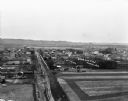
| Date: | 1909 |
|---|---|
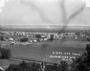
| Description: | An elevated view of a town in the Wisconsin River Valley. Fields surround the town, and low hills are in the far background. |
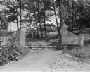
| Date: | 04 1925 |
|---|---|
| Description: | View of the wood trellis fence and columns that frame the entrance gate to the Silver-Dale Resort. A group of people are sitting on the porch of a refreshm... |
| Date: | 1931 |
|---|---|
| Description: | View of the entrance to the Devi-Bara Resort. There is sign on the fence that reads, "Saddle Horses - 1/2 block" and another sign on a tree denoting that t... |
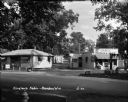
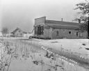
| Date: | 1930 |
|---|---|
| Description: | View from across road of a grocery store and gas station, with a home next door. The store features two pumps and advertises Deep Rock motor oil, Coca-Cola... |
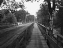
| Date: | 1912 |
|---|---|
| Description: | A bridge with both a wooden walkway for pedestrians and a dirt road for automobiles. Two men and a horse are standing on the other side of the bridge. |
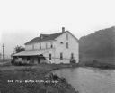
| Date: | 1925 |
|---|---|
| Description: | View along shoreline of a mill on a river. There is a man loading bags onto a cart at the front. There is a wooded hill on the right. |
| Date: | 1921 |
|---|---|
| Description: | Exterior view of Ludden's Poultry and Eggs from the dirt road. The shop features a porch, gable roof, and fenced yard. There are wooden crates and barrels ... |
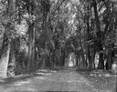
| Date: | 1913 |
|---|---|
| Description: | View down middle of tree-lined road of a carriage approaching from a distance. |
| Date: | 1913 |
|---|---|
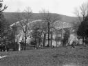
| Description: | Bird's-eye view of the village. Cropland and barns cover much of the landscape. |
| Date: | |
|---|---|
| Description: | A bird's-eye view of a farmland property with barns and farmhouse. |
| Date: | |
|---|---|
| Description: | View down hill of a bridge across a river. There are railroad tracks going along the shoreline under the bridge. |
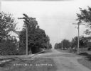
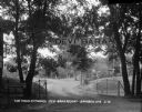
| Date: | |
|---|---|
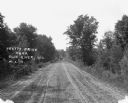
| Description: | A view down an unpaved road lined with utility poles. On the left is a sidewalk and a house partially hidden by trees. |

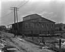
| Date: | 1922 |
|---|---|
| Description: | Exterior of the Chaseburg Cooperative Creamery and an attached secondary building. |

| Date: | |
|---|---|
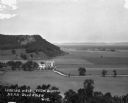
| Description: | View from hill over church and cemetery towards fields and town in a valley. |

| Date: | 1928 |
|---|---|
| Description: | Exterior view of gas station/restaurant outside the Triangle Tourist Park. The establishment offers Red Crown brand gasoline, Coney Island Red Hots, hot co... |
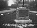
| Date: | 1920 |
|---|---|
| Description: | A stone monument dedicated to the Old Lead Road. The marker reads: "The Old Lead Road. In 1828, ox-teams, guided along an ancient Winnebago Indian Trail, b... |
| Date: | 1914 |
|---|---|
| Description: | Exterior of the Farmers' Alliance Store. On the side of the building are two signs that say: "Horseshoe Tobacco." |
If you didn't find the material you searched for, our Library Reference Staff can help.
Call our reference desk at 608-264-6535 or email us at: