Filter: Categories of Wisconsin Historical Images
Filter: Creator Name of Beck and Pauli Litho
Filter: Year of 1800-1899
Filter: Year of 1880-1889
Filter: Subject of rivers
Filter: Categories of Wisconsin Historical Images
Filter: Creator Name of Beck and Pauli Litho
Filter: Year of 1800-1899
Filter: Year of 1880-1889
Filter: Subject of rivers

| Date: | 1886 |
|---|---|
| Description: | Bird's-eye map of Hurley with insets Mining at the Colby, Hurley in 1885, and North Front of Silver Street. |

| Date: | 1886 |
|---|---|
| Description: | Bird's-eye map of Menomonee Falls. |

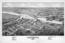
| Date: | 1881 |
|---|---|
| Description: | Darlington's first settlers arrived by 1826, attracted by the lead mines of the area. Arrival of the railroad in 1856 stimulated growth, and in 1857 the co... |

| Date: | 1885 |
|---|---|
| Description: | Bird's-eye map of Hustisford. |

| Date: | 1883 |
|---|---|
| Description: | Bird's-eye map of Manitowoc. |

| Date: | 1880 |
|---|---|
| Description: | Bird's-eye map of Neillsville, with inset. |
If you didn't find the material you searched for, our Library Reference Staff can help.
Call our reference desk at 608-264-6535 or email us at: