Search the Wisconsin Historical Society's collections

Searching for

Refine by

Results 1-11 of 11

Map or Atlas

Bird's-Eye View of Milwaukee

Date: 1872
Description: Bird's-eye map of Milwaukee on Lake Michigan.
Map or Atlas

De Pere, Wis.

Date: 1871
Description: Bird's-eye map of De Pere.
Map or Atlas

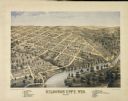
Kilbourn City, Wis.

Date: 1870
Description: Bird's-eye map of Kilbourn City, now known as Wisconsin Dells. Kilbourn City was platted in the 1850s and received a boost when the La Crosse and Milwaukee...
Map or Atlas

Mauston, Wis.

Date: 1870
Description: Bird's-eye map of Mauston.
Map or Atlas

Menasha, Wis.

Date: 1870
Description: Bird's-eye map of Menasha.
Map or Atlas

New London

Date: 1871
Description: Birds eye map of New London depicts street names and street locations, houses, trees, the bridge, Wolf River, and the bayou. At the bottom of the map, a re...
Map or Atlas

Sheboygan Falls, Wis.

Date: 1871
Description: Bird's-eye map of Sheboygan Falls.
Map or Atlas

Stoughton, Wis.

Date: 1871
Description: Bird's-eye map of Stoughton.
Map or Atlas

Tomah, Wis.

Date: 1870
Description: Bird's-eye map of Tomah.
Map or Atlas

Waupaca, Wis.

Date: 1871
Description: Bird's-eye map of Waupaca.
Map or Atlas

Weyauwega, Wis.

Date: 1870
Description: Bird's-eye map of Weyauwega.

Have Questions?

If you didn't find the material you searched for, our Library Reference Staff can help.

Call our reference desk at 608-264-6535 or email us at: