Filter: Categories of Wisconsin Historical Images
Filter: Type of Map or Atlas
Filter: Categories of Wisconsin Historical Images
Filter: Type of Map or Atlas

| Date: | 1877 |
|---|---|
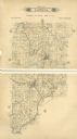
| Description: | A page from an illustrated historical atlas depicting five residences, including that of Conrad Ochsner. |

| Date: | 1915 |
|---|---|
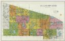
| Description: | A composite plat map of the towns of Mequon, Saukville, Belgium, Fort Washington, and Fredonia. |

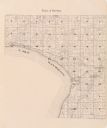
| Date: | 1921 |
|---|---|
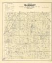
| Description: | A plat map of Mequon, Wisconsin. Text at top reads: "T. 9N. R.21 E MEQUON T. 9N. R.22 E." |

| Date: | 1923 |
|---|---|
| Description: | Color map of the "Interborough Rapid Transit System of Greater New York". |

| Date: | 1923 |
|---|---|
| Description: | The back side of the map of the "Interborough Rapid Transit System of Greater New York". |

| Date: | 1901 |
|---|---|
| Description: | Plat map showing land ownership of Township 21N Range 3W in Jackson County for 1901. Scale is 2 inches to 1 mile. |

| Date: | 1944 |
|---|---|
| Description: | Portage County Map. Includes the towns of Eau Plaine, Dewey, Sharon, Alban, Carson, Hull, New Hope, Linwood, Stockton, Amherst, Plover, Grant, Buena Vista,... |

| Date: | 1900 |
|---|---|
| Description: | A hand-drawn map of the battlefield of the Battle of Chickamauga. |

| Date: | 1935 |
|---|---|
| Description: | Polygonic projection map of the lower part of Lake Michigan, surrounded by the states of Wisconsin, Illinois, Indiana, Michigan. Includes handwritten text ... |

| Date: | 1976 |
|---|---|
| Description: | This color map displays Wisconsin and bordering areas of Iowa, Minnesota, Illinois, and Michigan. At the bottom is a map key indicating road classification... |

| Date: | 1973 |
|---|---|
| Description: | This map displays, in color, Wisconsin and bordering areas of Iowa, Minnesota, Illinois, and Michigan. At the bottom is a map key indicating road classifi... |

| Date: | 1887 |
|---|---|
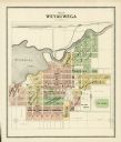
| Description: | A plat map of Waterford. Township 4, North Range 19, East of 4th Principal Meridian. References at bottom include school houses, houses, churches and cemet... |
If you didn't find the material you searched for, our Library Reference Staff can help.
Call our reference desk at 608-264-6535 or email us at: